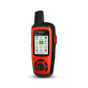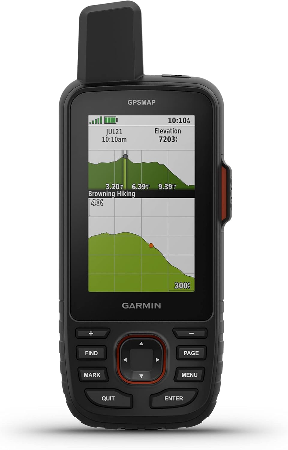
Garmin GPSMAP 67i
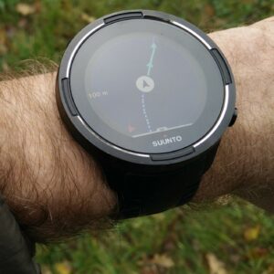
When you are hiking far away from the civilization you need reliable navigation. Smartphones are fantastic for day hikes and casual back‑country excursions, yet their batteries drain fast, screens can crack easily, and they often struggle to get a GPS fix in forests and narrow valleys. GPS watches are gaining popularity and are undoubtedly useful for navigation. Nevertheless, we prefer handheld GPS devices for their battery life, ease of use and in most cases superior maps. Many handheld GPS devices show detailed maps and in some cases, even satellite imagery. In contrast, most GPS watches can only display your location and direction concerning waypoints and routes (breadcrumb trail). The ability to easily insert new waypoints and plan routes directly on the device is another plus of handheld GPS devices. To achieve this on a GPS watch, you’d typically need a computer or a smartphone with a working internet connection.
Here we have selected the five best handheld GPS devices for 2026. Each unit offers rugged construction, multi‑GNSS support for faster fixes, outstanding battery life, and some even advanced safety features like SOS messaging. Use this guide to pick the right device for your next adventure – but remember that no GPS replaces basic navigation skills. You should never do a trail you don’t know without a map and compass.
Updated Content
We regularly update our reviews and selections to always recommend you the best products on the market.
Expert Selections
We only list top-tier products. Read how our selections of best hiking products differ from others here.
Links
We use affiliate links and may receive a small commission on purchases at no extra cost to you.
1. Our Hiking GPS Picks
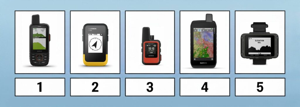
The Best Hiking GPS
- Garmin GPSMAP 67i – Best overall GPS for hiking
- Garmin eTrex SE – Best budget hand-held GPS
- Garmin inReach Mini 2 – Best ultra‑light GPS and satellite messenger
- Garmin Montana 700 – Best touchscreen GPS
- Garmin Foretrex 801 – Best hands‑free GPS
2. Comparison of Hiking GPS Devices
| Feature/Product | Garmin GPSMAP 67i | Garmin eTrex SE | Garmin inReach Mini 2 | Garmin Montana 700 | Garmin Foretrex 801 |
|---|---|---|---|---|---|
| Weight | 8.11 oz. | 5.5 oz. | 3.5 oz. | 14.5 oz. | 3.8 oz. |
| Weight (Metric) | 230 g | 155 g | 100 g | 410 g | 108 g |
| Size | 2.5 x 6.4 x 1.4 in. | 2.4 x 4.0 x 1.3 in. | 2.04 x 3.9 x 1.03 in. | 3.4 x 7.2 x 1.3 in. | 2.9 x 1.9 x 0.9 in. |
| Size (Metric) | 6.2 x 16.3 x 3.5 cm | 6.1 x 10 x 3.3 cm | 5.17 x 9.9 x 3.6 cm | 8.76 x 18.3 x 3.3 cm | 7.3 x 4.8 x 2.2 cm |
| Display | 3'' | 2.2" | 1.3" | 5" | 2.2" |
| Touchscreen | No | No | No | Yes | No |
| Battery Life | 180 hr / 840 hr | 168 hr / 1 800 hr | 14 days / 30 days | 18 hr / 330 hr | 100 hr / 1 000 hr |
| Battery | Rechargeable lithium-ion | 2 AA batteries (not included) | Rechargeable lithium-ion | Rechargeable lithium-ion or 3 AA batteries | 2 AAA batteries |
| Technology | GPS + Galileo + BeiDou + IRNSS + QZSS | GPS + GLONASS + BeiDou + Galileo | GPS + Galileo + QZSS | GPS + GLONASS + Galileo | GPS + GLONASS + Galileo |
| Electronic Compass | Yes | Yes | Yes | Yes | Yes |
| Barometric Altimeter | Yes | Yes | Yes | Yes | Yes |
| Waterproof | Yes (IPX7) | Yes (IPX7) | Yes (IPX7) | Yes (IPX7) | Yes (IPX7) |
| Memory Card Support | Yes | Yes | Yes | Yes | Yes |
| Routes Memory | 250 | 100 | 100 | 250 | 50 |
| POIs Memory | 20000 | 1000 | 1000 | 20000 | 500 |
| Supports Standard Batteries | No | Yes (2 AA batteries) | No | Yes (3 AA batteries) | Yes (2 AAA batteries) |
| Wireless Connectivity | Bluetooth, Wi-Fi and ANT+ | Bluetooth | Bluetooth, ANT+ | Bluetooth, Wi-Fi and ANT+ | Bluetooth, ANT+ |
| Camera | No | No | No | Optional (750i model) | No |
| Geocaching-friendly | Yes | Yes | Yes | Yes | No |
| Trip Planning Software | Yes (BaseCamp, Garmin Explore) | Yes (BaseCamp, Garmin Explore) | Yes (BaseCamp, Garmin Explore) | Yes (BaseCamp, Garmin Explore) | Yes (BaseCamp, Garmin Explore) |
3. The Selection
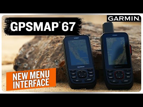
Garmin GPSMAP 67i
Garmin GPSMAP 67i
Best overall GPS for hiking
Best for:
- Adventurers who want a single device for navigation and satellite communication.
- Long expeditions where battery life and accuracy are critical.
- Users who prefer buttons over touchscreens (great for cold conditions when you’re wearing gloves)
Garmin’s GPSMAP 66 series dominated high‑end handhelds for years, but the GPSMAP 67i raises the bar. A quad‑helix antenna and multi‑band GNSS (GPS, GLONASS, Galileo, QZSS, BeiDou and IRNSS) deliver remarkable accuracy even in canyons and under heavy tree cover. The rechargeable lithium‑ion pack lasts for around 180 hours of tracking (up to 840 hours in expedition mode). It comes preloaded with TopoActive maps, offers satellite imagery downloads, and includes built‑in inReach messaging so you can text or send an SOS from anywhere (an active satellite subscription is required). At 8.1 oz it’s not ultra‑light, but the device does have a very durable IPX7‑rated body and drop‑resistant case. Users appreciate the improved battery life and reliability over the 66i, though the price is steep and the button‑based interface feels dated compared to modern touchscreens.
Pros:
- Multi‑band GNSS for excellent accuracy even in dense forest or canyons
- Built‑in inReach messaging and SOS; no need for a separate satellite messenger
- Long battery life; rechargeable battery eliminates disposable AA cells
Cons:
- Expensive and heavier than simpler units
- Requires an ongoing subscription to use the inReach messaging features

Video
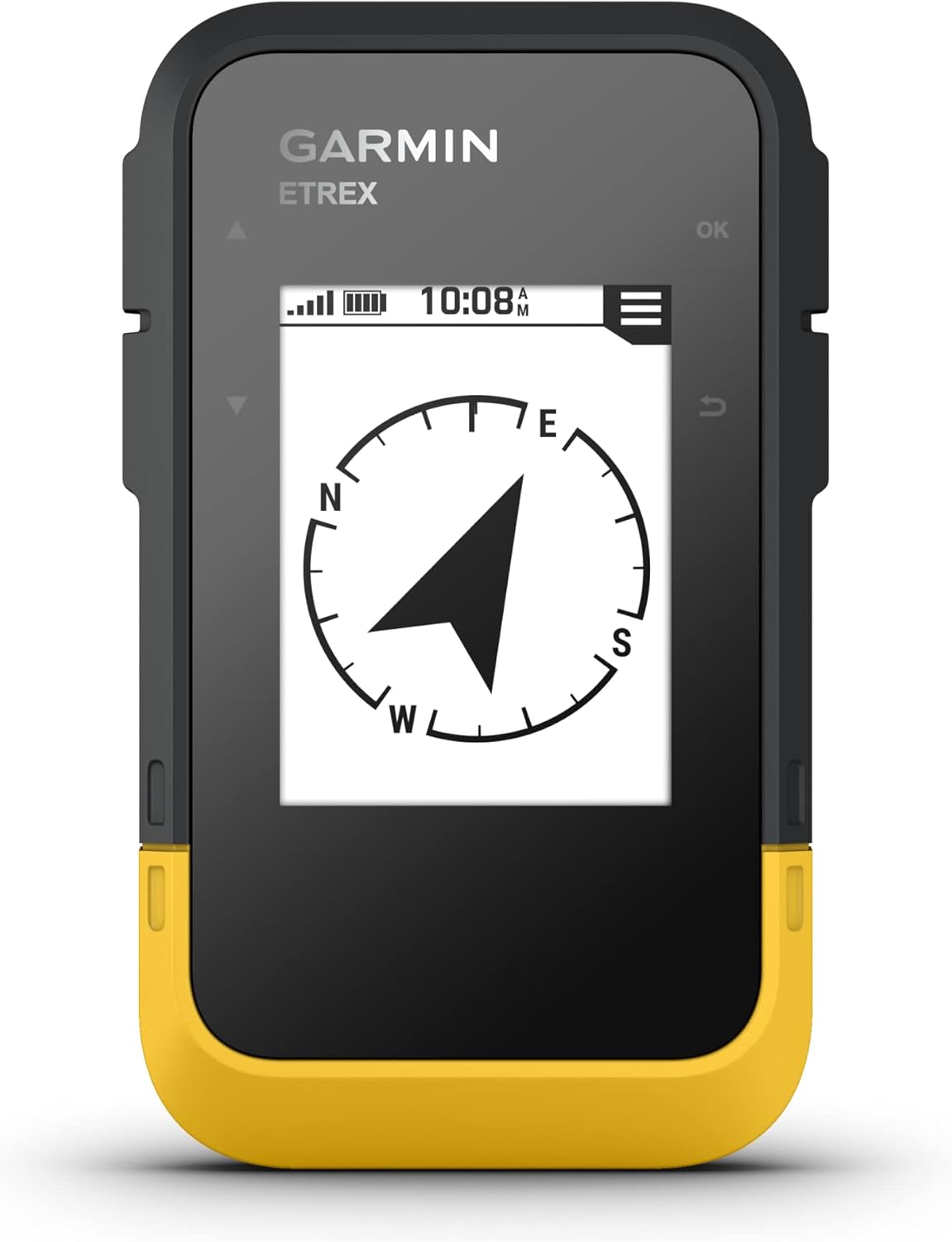
Garmin eTrex SE
Garmin eTrex SE
Best budget GPS
Best for:
- Budget‑conscious hikers or backpackers.
- Travelers who want a GPS that runs on easy‑to‑find AA batteries.
Garmin revived its entry‑level line with the eTrex SE, and it represents excellent value. It lacks preloaded maps, but pairing it with the Garmin Explore app on your phone gives you full route planning and downloading capabilities. The simple monochrome screen may look dated, yet it’s crisp in bright sunlight and consumes very little energy: two AA batteries last 168 hours in standard mode and up to an incredible 1 800 hours in expedition mode. Despite the low price, the SE uses GPS, GLONASS, Galileo, QZSS and BeiDou satellites and features a basic digital compass for heading information. It doesn’t support Wi-Fi. However, it has Bluetooth so you can connect it to your smartphone and import routes from there. It’s perfect for hikers who want a dependable, inexpensive device that runs on readily available batteries
Pros:
- Extremely long battery life on standard AA batteries
- Affordable and rugged, with IPX7 water resistance
- Multi‑GNSS support for improved accuracy
Cons:
- No detailed maps
- Relies on smartphone for route management

Video
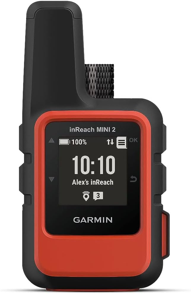
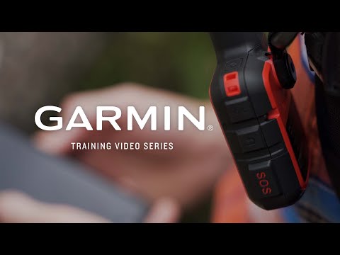
Garmin inReach Mini 2
Garmin inReach Mini 2
Best ultra‑light GPS and satellite messenger
Best for:
- Ultralight backpackers, climbers and trail runners who care about weight
- Travelers headed to regions with no cell coverage who still want to send texts
- People who already use their phone for maps but need a dedicated SOS messenger
If your priority is weight and safety, the inReach Mini 2 is the ultimate back‑country lifeline. At just 3.5 oz it disappears on a pack strap yet still connects with GPS, Galileo, QZSS and BeiDou satellites and offers a digital compass. The second‑generation Mini doubles battery life: with 10‑minute tracking you can get about 14 days of navigation, or 30 days in a low‑power mode. The device can’t display maps – you’ll need the Garmin Explore or Garmin Messenger apps on your phone. However it does support two‑way satellite messaging and SOS via the Iridium network. The Mini 2 is a great device for expeditions; its small screen makes navigation a bit fiddly, but when paired with a phone or used for messaging it’s unbeatable.
Pros:
- Featherweight and pocket‑sized
- Two‑way messaging and SOS capability via Iridium network
- Improved battery life compared to the original Mini, with flexible tracking intervals
Cons:
- Very small screen makes navigation difficult; best used with a paired smartphone
- Requires a paid subscription for satellite communications
- Limited stand‑alone functionality; it’s primarily a satellite messenger and tracker

Video
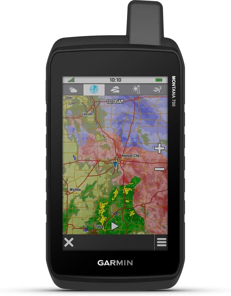
Garmin Montana 700
Garmin Montana 700
Best for:
- Back‑country travelers who want large, full‑colour maps and turn‑by‑turn directions
- Those who prefer touchscreen controls over physical buttons
Those who want a big touchscreen and the ability to switch seamlessly between driving, biking and hiking will love the Montana 700. With a 5‑inch 480×800‑pixel display, the Montana 700 beats most other handheld GPS devices and operates much like a rugged smartphone. The interface supports on‑road and off‑road routing, multi‑GNSS reception, and sensors including a 3‑axis compass, barometric altimeter and accelerometer. It comes with 16 GB of storage, a micro‑SD slot, built‑in Wi‑Fi and Bluetooth, and includes TopoActive maps and a year of Birdseye imagery. Battery life is less impressive – around 18 hours in GPS mode or 330 hours in expedition mode – and at 14.5 oz it’s by far the heaviest unit here. The Montana 700 doesn’t include inReach, but the 700i and 750i variants add messaging at additional cost. For trips where weight is less of a concern, the Montana offers a great navigation experience.
Pros:
- Huge 5‑inch touchscreen with high resolution
- Versatile mapping: TopoActive maps, City Navigator support, and BirdsEye satellite imagery
- Robust feature set including ABC sensors, Wi‑Fi, Bluetooth and ANT+
Cons:
- Heavy and bulky; won’t fit in most pockets
- Battery life is shorter than button‑based units
- Expensive, especially if you upgrade to the 700i/750i for inReach messaging

Video

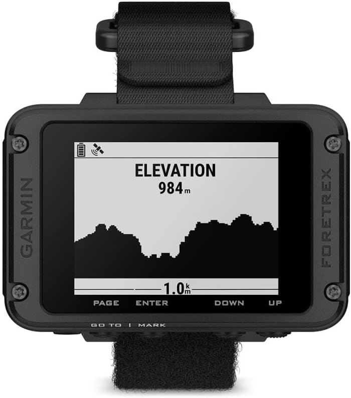
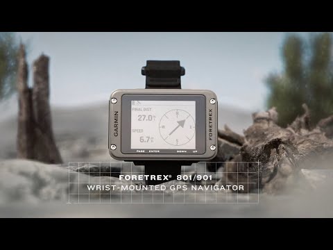
Garmin Foretrex 801
5. Garmin Foretrex 801
Garmin Foretrex 801
Best for:
- Military personnel, search‑and‑rescue teams and mountaineers who need to keep their hands free
- Ultralight hikers and trail runners wanting a wearable GPS recorder
- Users who like buttons and simple menus
Wrist‑mounted GPS units have been around for years, but the Foretrex 801 is the most capable ever produced. It uses multi‑band GNSS for improved accuracy and delivers around 100 hours of battery life in GPS mode, or up to 1 000 hours in expedition mode. The monochrome screen is small but easy to read in any light, and the rugged body meets military standards (MIL‑STD‑810) for thermal shock and water resistance. Garmin added tactical modes like Jumpmaster (for parachuting), Stealth (no radio transmission) and a Kill Switch for security conscious users. The device connects to the Garmin Explore app via Bluetooth for mapping and, when paired with an inReach device, can send messages or SOS. There’s no built‑in mapping or satellite messaging, but if you need a hands‑free unit that you can glance at while scrambling or climbing, the Foretrex 801 is a great solution.
Pros:
- Wrist‑mounted design keeps your hands free
- Multi‑band GNSS and impressive battery life for its size
- Built to military specifications with tactical features like Jumpmaster and Stealth mode
Cons:
- No cartography
- Small screen limits the amount of information you can view at once
- Requires pairing with another device for satellite messaging or detailed navigation

Video
4. Hiking GPS Buying Advice – What is important?
Maps and Navigation Features
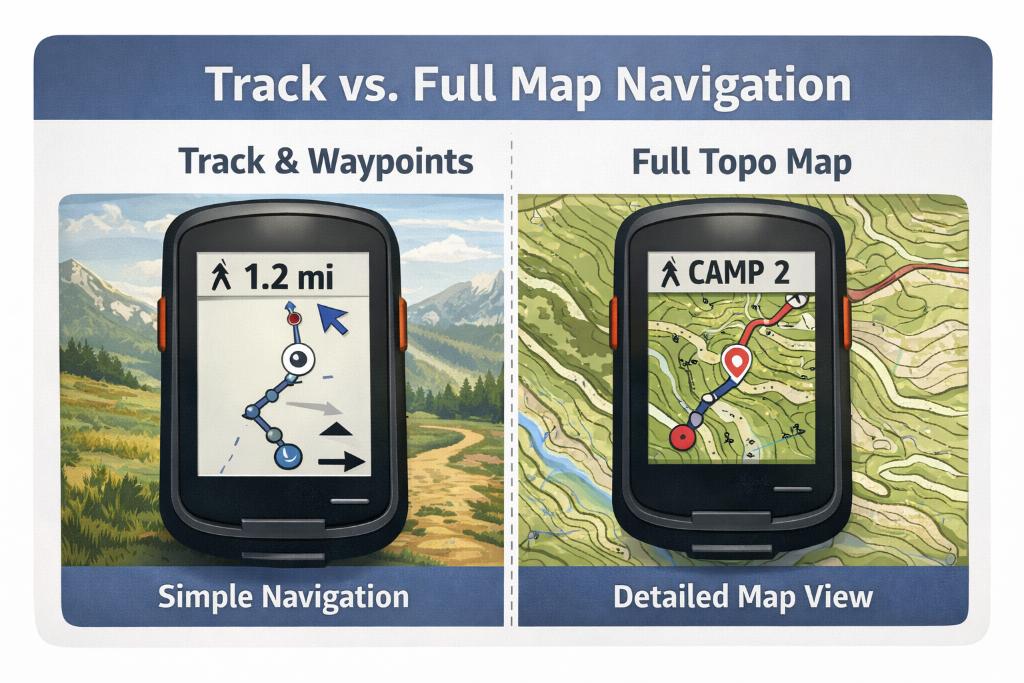
GPS Devices: Breadcrumb vs Detailed Map
The biggest difference between budget GPS units and premium models is how you navigate day to day. Some devices are essentially “breadcrumb” tools: they record tracks, let you mark waypoints, and guide you back to a point you’ve saved, but they don’t give you a detailed, full-colour topographic map right on the device. That’s totally fine if you’re following established trails, geocaching, or you mainly want a reliable backup to your phone. But if you hike in complex terrain above treeline, in bad visibility, in dense forest with lots of junctions, or off-trail—having proper on-device mapping becomes a massive upgrade. You’ll want preloaded topo maps (contours + terrain detail), the ability to load GPX routes, enough internal storage, and ideally microSD support for big regions and multiple map layers.
Also think about how you’ll get those maps. Some brands make it easy to download and manage maps with their own apps, while others lean on computer-based planning. Satellite imagery can be a nice bonus for certain use cases (finding clearings, seeing riverbeds, spotting tracks), but it’s not essential for most hikers—and it can come with subscription costs. If you value simple “grab-and-go” navigation, pay for convenience. If you’re the type who enjoys planning routes at home, you can often build an excellent map setup without turning the GPS into an expensive monthly bill.
Satellite Networks and Accuracy
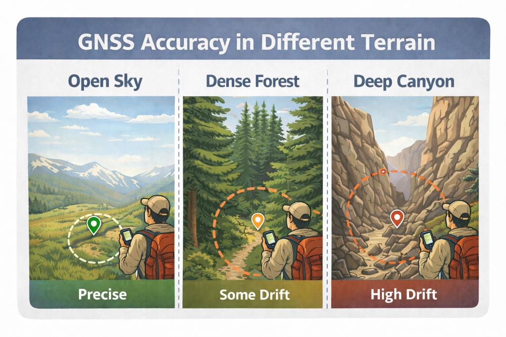
GPS Devices: Accuracy in Different Terrain Types
“Accuracy” is one of those specs that sounds boring until you’re standing in a narrow valley, in thick tree cover, or in a canyon where your position jumps around and the trail on the screen stops matching the trail under your feet. This is where modern GNSS hardware matters. Almost all current handhelds support multi-GNSS, meaning they can use more than one satellite system (GPS plus alternatives like Galileo, GLONASS, etc.). The practical advantage is faster lock-on and a more stable position fix, especially when the sky view is limited. Some higher-end units also add multi-band (dual-frequency) reception, which improves accuracy by reducing common errors from reflections and atmospheric interference. The gain is most noticeable in difficult environments: forrests, steep-walled valleys, cliffy terrain etc.
That said, accuracy isn’t only the chipset. It’s also antenna design, firmware, and how you carry the device. A GPS stuffed in a backpack lid or deep in a pocket will often perform worse than one clipped outside with a clear sky view. Many devices let you choose between max accuracy and battery-saving modes, so you can “spend” power when you need precision and save power when the terrain is straightforward. Bottom line: if your hiking is mostly open trails in good conditions, basic multi-GNSS is enough. If you routinely navigate in technical terrain, multi-band support is one of the most meaningful upgrades you can buy.
Touchscreen/Buttons and Readability
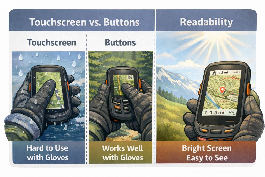
GPS Devices: Touch Screen VS Buttons
Touchscreens are intuitive and feel familiar if you’re used to phones: panning maps is fast, zooming is easy, and typing is quicker. They’re great when you’re moving fast and want a big, clear map at a glance—especially if the GPS doubles as an off-road, motorcycle, or vehicle navigation tool. The trade-off is that touchscreens can be frustrating in cold weather, with gloves, or in heavy rain. Even when they work, they often demand more attention and can drain battery faster, especially if you keep the backlight up.
Button-based devices are the opposite: they can feel “old-school,” but they’re reliable. You can operate them with gloves, in sleet, and in winter conditions without fighting the screen. They’re also easier to use one-handed while walking, and many hikers prefer physical controls for quick waypoint marking and menu navigation. Display quality matters either way: size, brightness, anti-glare performance, and contrast in direct sunlight are what decide whether you can read the map without stopping. A small screen can be perfectly usable if the UI is clean and you mostly follow tracks. But if you want to interpret terrain contours, spot junctions quickly, and plan on the fly, screen size and readability become a major reason to step up to a higher-end model.
ABC Sensors and Extra Features
A good hiking handheld GPS is more than a dot on a map. The most useful “extra” features are the classic ABC trio: altimeter, barometer, and compass. A 3-axis electronic compass is huge because it gives reliable heading information even when you’re standing still (or holding the device at an angle). That matters when you’re trying to orient yourself at a confusing junction, in fog, or when you’re checking bearings without walking in circles. A barometric altimeter can give a more stable elevation reading than GPS-only elevation in many conditions, which helps when you’re locating yourself on a topo map (elevation + terrain features is often the fastest way to confirm position). The barometer can also be genuinely useful for weather awareness: trend matters more than the exact pressure number. If you see pressure dropping quickly, you know you should start thinking about exposure, ridgelines, and exit options.
Beyond ABC, many handhelds add smart connectivity: syncing tracks to an app, showing phone notifications, pairing external sensors, or sharing routes with friends. These aren’t must-haves for everyone, but they can be excellent if you like analyzing your routes later or you want a smoother planning workflow. Just remember: the more you turn your handheld into a “connected device”, the more you need to manage battery and settings. For pure backcountry navigation, the best extras are the ones that still work when everything else (signal, phone, weather) is going sideways.
Messaging, SOS, and Subscriptions
If you hike beyond cell coverage, satellite communication can be the single biggest safety upgrade, bigger than maps, screen size, or GNSS. But it’s important to be clear on what you need. Only devices with true two-way satellite messaging let you send and receive messages from anywhere with a clear view of the sky, and the SOS function adds another layer of safety for serious backcountry travel. For some hikers, this is peace of mind on solo trips. For others, it’s practical: checking in with family, coordinating pickups, or getting help when plans change. The key is that you’re not just buying a device—you’re buying into a subscription ecosystem. Plans vary, and costs add up differently depending on whether you send occasional check-ins or frequent messages and tracking.
Also consider usability. Messaging on a tiny screen can be slow and annoying, which is why pairing with a smartphone can make a big difference for comfort and speed—while still keeping the satellite device as the “signal”. If your trips are mostly day hikes in well-traveled areas, SOS may be nice but not essential. If you’re going remote, crossing big mountain terrain, winter hiking, or traveling internationally where rescue logistics can be complicated, it becomes much more compelling. A common strategy is either: (1) one device that does mapping + messaging, or (2) a strong mapping GPS plus a dedicated messenger. Pick the setup that you’ll actually carry every time.
Battery Life
Battery claims look impressive on paper, but what matters is how long the device lasts in your usage: tracking frequency, screen brightness, GNSS settings, sensor use, wireless connectivity, and temperature. For hiking, long battery life is one of the main reasons handheld GPS units still beat phones. If you’re tracking all day, navigating off-route, and checking the screen frequently, you’ll burn power much faster than “max battery” marketing numbers suggest. Devices often offer multiple power modes (including expedition-style modes) that reduce tracking points, dim the screen, and shut off wireless features to stretch battery life dramatically.
Battery type matters just as much. Rechargeable internal packs are convenient and reduce waste, especially if you already carry a power bank. AA-powered devices can be brilliant for longer trips because you can swap batteries instantly and keep moving—no cables, no waiting. Cold weather is the wildcard: batteries drain faster in low temperatures, so storing the unit close to your body and minimizing screen-on time helps a lot. In practice, the best strategy is simple: bring redundancy. For long trips, that means spare AAs or a power bank. For short trips, it means starting fully charged and knowing how to switch to a power-saving mode when you don’t need constant tracking.
Durability, Waterproofing and Environment
A hiking GPS should be the device you’re least worried about when the weather turns ugly. That means real water resistance, solid impact protection, and a case that can handle being clipped to the outside of your pack for days. Waterproofing is important not only for rain, but also for accidents: dropping it in a stream, getting soaked while fording, or being exposed to wet snow. Look for strong water resistance ratings and don’t ignore the small things—port covers, button seals, and how the device behaves when it’s wet (some touchscreens become much less pleasant in heavy rain). Shock resistance matters too. A GPS is often used one-handed, pulled out frequently, and occasionally dropped. A protective case or screen protector can be worth it if you’re hard on gear.
If you expect harsh conditions—winter trips, desert heat, or high mountains—environmental testing standards become more relevant. Thermal resistance and impact certifications can be a good sign that the device is built for real outdoors use, not just “weather-resistant” marketing. Also pay attention to the weak points: charging ports, battery doors, and attachment points. Many issues in the field aren’t “the GPS failed”, but rather “the hinge cracked”, “the port got damaged”, or “the mount broke”. Choose a device you can confidently handle with cold hands, wet gloves, and rushed decisions—because that’s exactly when you’ll rely on it most.
Size, Weight and Carry Options
For hiking, smaller is usually better. A compact GPS is easier to carry in a pocket, stash on a shoulder strap, or keep accessible without digging through your pack. That leads to more frequent use, which is the whole point of having a dedicated device. Lightweight gear also reduces fatigue and makes the GPS feel like a no-brainer addition rather than “one more gadget”. The trade-off is screen size and sometimes battery capacity. If the screen is tiny, on-device mapping becomes less comfortable and you’ll rely more on following tracks or using a paired phone for a better map interface.
Bigger devices often shine when you want a large, bright display and fast touch navigation, or when you’ll mount the unit on a bike, ATV, snowmobile, or vehicle. In those cases, the size and weight matter less because the device isn’t living in your hand all day. For pure hiking and backpacking, most people land in the middle: big enough to read the map without squinting, small enough to carry without thinking about it.
Planning Software
A handheld GPS is only as good as the workflow you use before and after the trip. If you love planning routes, you’ll want a device that makes it easy to import GPX tracks, manage waypoints, and organize multiple trips without turning everything into a messy file pile. Good planning software (desktop or app-based) helps you build routes, see distance and elevation profiles, and set critical points like trailheads, water sources, bailout routes, and camps. It also makes post-trip analysis easier if you like reviewing your tracks. For simpler devices that don’t have strong onboard maps, a companion app can be essential because it turns your phone into the “big screen map” while the GPS provides the reliable tracking and positioning.
Also look at how the device handles syncing: Bluetooth, Wi-Fi, and wireless sharing can be genuinely useful, especially if you want to transfer routes quickly, share tracks with friends, or keep a backup of your data. But don’t buy into features you won’t use. Some people want a standalone unit that does everything on the device, offline, no fuss. Others want the GPS as part of a system: phone for planning, GPS for tracking, satellite messenger for SOS. The best choice is the one that matches how you already hike. If the setup is annoying, you’ll skip it. If the workflow is smooth, you’ll use your GPS more often and that’s when it actually becomes a safety and navigation advantage.