The Quick Answer
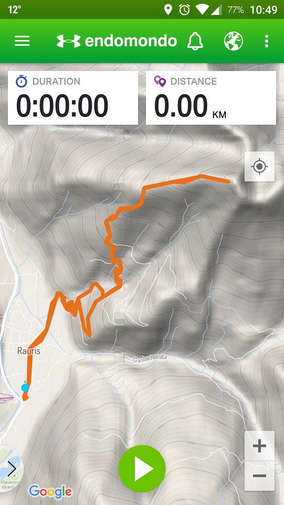
GPS Track in Endomondo App
If you are into hiking, you have probably already heard about GPS tracks also known as GPS routes, GPS trails etc. GPS tracks are very useful for hiking because they make it simple and hassle-free to navigate on trails. A GPS track contains information about the trail such as geographical coordinates, altitude and distance. You can find GPS tracks on the internet or create them yourself. Most modern GPS-enabled devices (smartphones, GPS watches, handheld GPS devices etc.) support GPS tracks and can display them as an overlay (line) on a map – see the image on the right. If you have the GPS track for a hike and an device which can render it, navigation gets very easy – you just follow the line on the screen until you reach your destination.
However, keep in mind that electronic devices tend to run out of batteries on long hikes and that GPS signal is not available everywhere. Therefore, you should always have a backup (e.g. map and a compass).
In the following we will explain what GPS tracks are, how to use them for hiking and how you can create them yourself. I’ll also list the best resources for finding GPS tracks online.
Table of contents:
- What are GPS tracks?
- How to use GPS tracks for hiking?
- Resources for GPS tracks online
- How to create GPS tracks?
What are GPS tracks?
GPS tracks are files which contain data like geographical coordinates, altitude, distance and time in format such as GPX or KML which is an XML schema designed for software applications. Sounds complicated? Let’s put it in a simpler way: GPS tracks contain multiple points on the map which form a route (line) towards the destination. On the display of your device you can see your current location and direction in relation to the hike’s route (shown as a line). GPS tracks can be recorded with GPS-enabled devices or created with specific software. People often share GPS tracks from hikes they have completed and therefore you can easily download them from the internet to your device.
Note: GPS tracks come in different formats (GPX, KML etc.). We recommend using GPS tracks in GPX format (check that the file has a gpx extension) as this format is supported by most devices. Furthermore, it usually also contains more data (altitude, distance etc.) than other formats.
How to use GPS tracks for hiking?
Once you have the right GPS track you need to transfer it to your GPS-enabled device (smartphone, handheld GPS device or GPS watch).
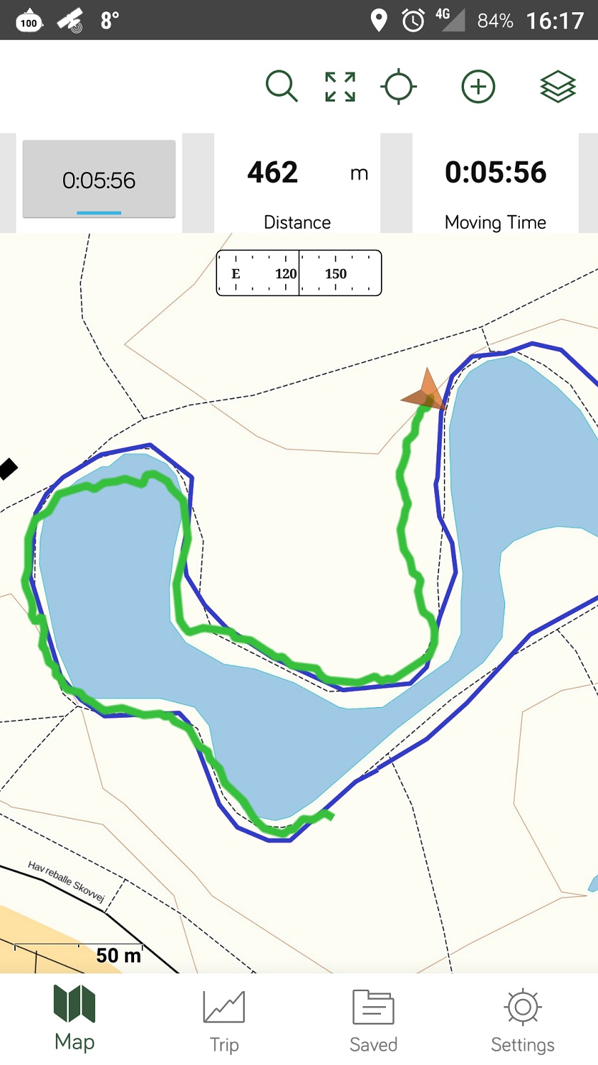
Gaia GPS Hiking App
How to Use GPS Track with a Smartphone?
To use GPS tracks with your smartphone, you will need an app that supports GPS tracks. I recommend using Gaia GPS which is available both for iOS and Android devices. Gaia GPS is a very simple app which shows the route from GPS track, your position and the map on the screen of your smartphone. The app also supports topographic maps (see more here). The biggest limitation of Gaia GPS is that it requires internet connection to show the map. The premium version of the app does not have this limitation because it supports offline maps. See pricing for the premium version here.
Importing GPS trails to Gaia GPS is very simple. You simply transfer the track in gpx format to your smartphone and then open the file with Gaia GPS app. Here are more detailed instructions for Android and iOS.
Other apps that support GPS tracks are:
- Green Tracks (Android only)
- Gaia GPS
- AllTrails
- Komoot
- A-GPS Tracker (Android only)
See our test of these apps in our article Best Hiking Apps – Test and Review.
How to Use GPS Track with a Handheld GPS Device?
Handheld Garmin GPS devices also support GPS tracks. Importing GPS tracks to Garmin devices is very easy. First, you should connect your device to your computer using the USB cable. The computer will detect the device and open a dialog window. Select “open folder to view files” and then find the “new files” folder. The folder is sometimes hidden and therefore you should enable “show hidden folders” in your file manager. Copy the GPS track (from the internet) into this folder and then select “Courses” on the GPS device. Find the route which you just imported and select it.
How to Use GPS Track with a GPS Watch?
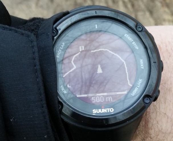
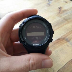
GPS Track on Suunto Ambit 2 Watch
Many Suunto and Garmin GPS watches support GPS tracks. For example Suunto 9, Suunto Ambit, Garmin Fenix, Garmin Forerunner etc. However, most GPS watches don’t support maps. They only show your location and direction in relation to the GPS track. This is not a problem if you are planning to stick to the track but becomes tricky if you want to wander far off the trail. However, the new Garmin Fenix 6X watch also supports maps. That means that it shows GPS track as an overlay on a topographic map.
Transferring GPS tracks to Garmin watches is done via Garmin Connect app. See instructions here.
To import GPX tracks to Suunto watches you will have to use the Suunto app. See instructions here.
Resources for GPS tracks online?
We have good experience finding GPS tracks for hiking on Wikiloc, Komoot and AllTrails. All three websites allow you to download GPS tracks for free and use them with whichever device you want. However, registration is required to find and download GPS tracks on the respective websites. All hikes published on our website also come with GPS tracks. Check out the trails section.
How to create GPS tracks?

Recording a GPS track with Suunto 9 watch
There are two ways to create GPS tracks; you can record them with a GPS-enabled device or create them with software (app, web app etc.).
Recording GPS tracks
You can record GPS tracks with a smartphone, handheld GPS device or a GPS watch.
For recording GPS tracks with a smartphone, we recommend using the Gaia GPS app. In the app you can easily record GPS tracks and then export them in GPX format. To learn how to export GPS track in Gaia GPS app check out this guide.
If you are using a handheld GPS device you need to record your activity and then save the track. Then you connect the GPS device to your computer (via USB cable) and simply transfer the file (with gpx extension) to your hard drive. Note that the GPS device will appear as an additional drive when you connect it to a computer.
To export a GPS track from a Garmin or Suunto GPS watch you need to record your activity and then sync the watch with Suunto app (Suunto Watches) or Garmin Connect (Garmin Watches). Then find the track in the app and click “export”.
Creating GPS tracks with software
Gaia GPS web app allow you to create (draw) tracks/routes on a map and then export them in GPX format. The web app features good topographic maps and shows route’s elevation profile. Creating track is thus very easy. See more about creating tracks in Gaia GPS here.
Do you have any questions about GPS tracks or want to share your thoughts? Drop us a line the comments section below.


i need to learn how to use a GPS for tracking and finding specific area or point
Hi Vincent, there are many smartphone apps that have tracking feature. For finding a specific point, you can simply create a GPX route to that point and import it to one of these apps. I recommend going for Gaia GPS because it supports tracking as well as route planning. Other alternative are AllTrails, Komoot etc.
Regards,
Blaz