Myli Gorge Hike
About the Perivolia – Myli Gorge – Chromonastiri Hiking Trail
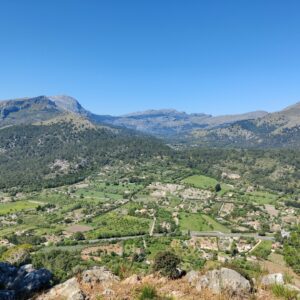
During the fall holidays we spent a week on the beautiful Greek island of Crete where we combined swimming, sightseeing and of course hiking. We stayed in the coastal city of Rethymno which we really liked. The old town is full of narrow streets, Venetian architecture and cozy taverns, but the city also has a long sandy beach and excellent weather well into autumn. October turned out to be a perfect time to visit. The sea was still warm enough for daily swims (+ 20 C) while the temperatures were comfortable for hiking.
Since we didn’t rent a car during this trip, we relied entirely on public transport to reach different hiking areas. For our first hike we decided to explore the beautiful Myli Gorge, starting from Perivolia on the outskirts of Rethymno and finishing in the mountain village of Chromonastiri. This hike combines several different landscapes in a relatively short distance and is particularly convenient for those staying in Rethymno without a car. The starting point in Perivolia is easily reachable by local bus from Rethymno, while the hike ends in the mountain village of Chromonastiri where you can take a bus back to the city. Along the way, you begin in suburban surroundings close to the sea, continue through olive groves and small villages, and finally enter the shaded and surprisingly wild Myli Gorge with its abandoned mills, steep walls and dense vegetation.
The trail is not technically difficult, but parts of the gorge are narrow, rocky and muddy, especially after rain. Proper footwear is therefore important. Even though the hike is relatively short, the constant ascent combined with slippery terrain can make it feel demanding. We completed the trail with two small children aged 2 and 5, which turned the adventure into a memorable family expedition, especially because we made the questionable decision to bring a stroller into the gorge.
The route described here ascends approximately 470 meters over 8.6 kilometers and reaches the highest point of 367 meters above sea level. We completed the hike in a bit less than four hours including short breaks.
Perivolia – Myli Gorge – Chromonastiri Hiking Trail Details
Physical Difficulty
Medium
Technical Difficulty
Easy
Duration
3 h 59 min
Distance
8.61 km
(5.35 mi.)
Ascent
470 m
(1542 ft.)
Descent
112 m
(367 ft.)
Highest Point
367 m
(1204 ft.)
Lowest Point
1 m
(3 ft.)
Date of the Hike Date when we did this hike ?
October 2025
Weather On the day when we did this hike ?
Mostly Sunny
Temperature On the day when we did this hike ?
22° C
(72° F)
Wind On the day when we did this hike ?
10 km/h
Perivolia – Myli Gorge – Chromonastiri Hiking Trail GPS Route and Trail Description
*Click on the chart to see the location on the map
GPX route helps you with the navigation on a hike. It can be used with a smartphone, handheld GPS device or a GPS watch.About GPX Route
Reaching the starting point
Myli Gorge Trail: The starting point of the hike that’s reachable by public transport
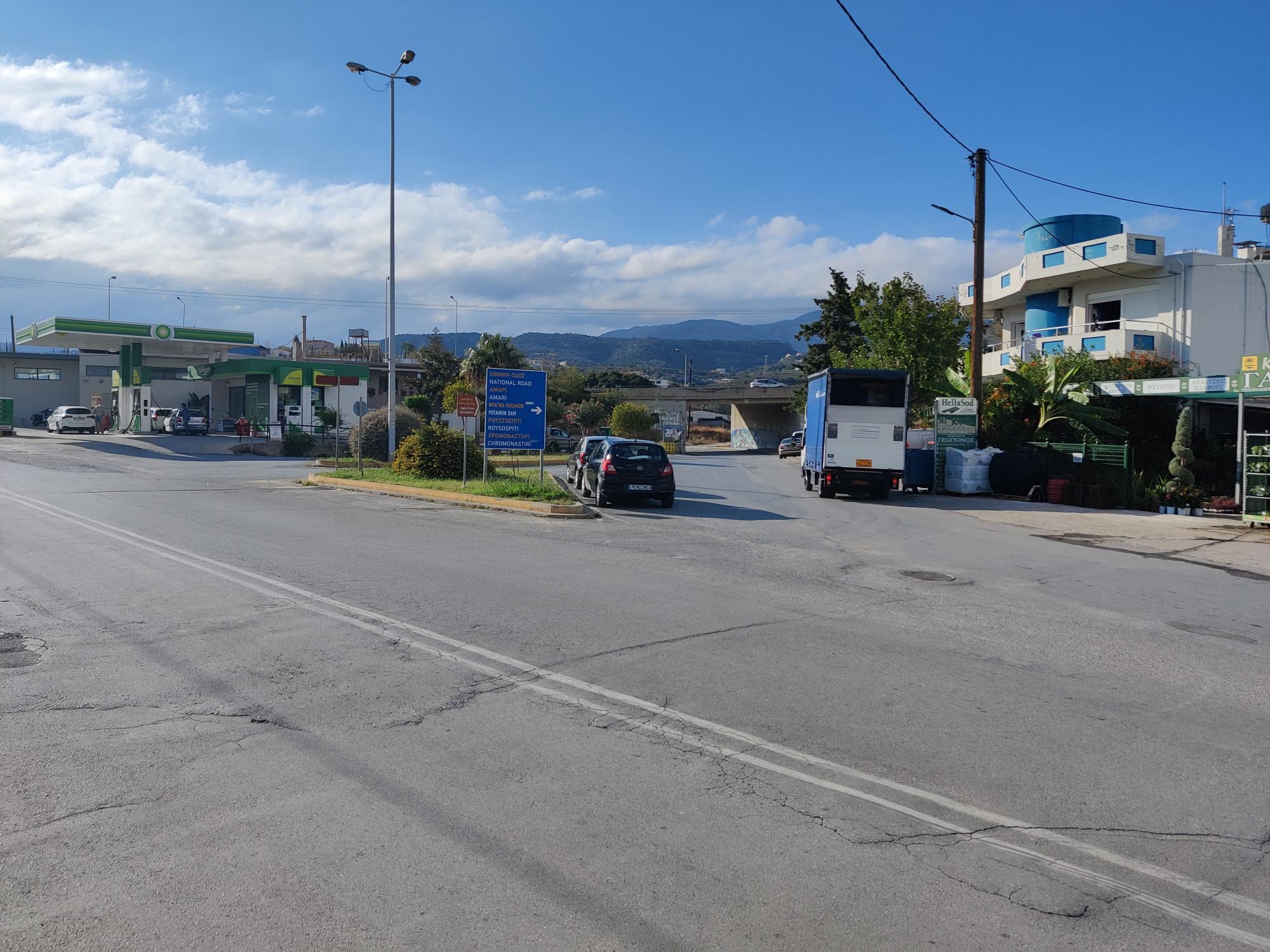
This hike starts at the Perivolia bus stop east of Rethymno. We went there by local KTEL bus which connects the center of Rethymno with the eastern suburbs and nearby beach areas. Buses towards Perivolia run frequently throughout the day and the journey only takes a few minutes.
For current schedules and ticket prices, it’s best to check the official KTEL Chania–Rethymno website before your hike.
To return from Chromonastiri you should also take bus. The village is served by local KTEL lines running between Rethymno and several inland villages including Myloi, Chromonastiri and Agia Irini. The bus stop is located on the northern side of the village along the main road towards Prasies. Connections are not frequent, so make sure to check departure times in advance.
Trail Description

Myli Gorge Hike: The first part of the hike is on asphalt road
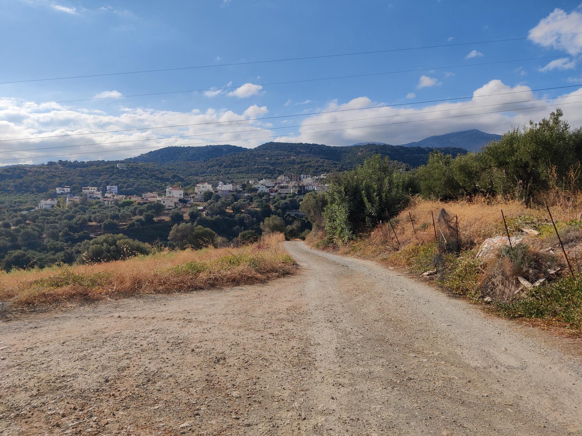
From the Perivolia bus stop, the hike begins on an asphalt road heading south towards the small settlement of Xiro Chorio. The first stretch is not particularly exciting scenery-wise, but it gives you a gradual transition from the busy coastal atmosphere of Rethymno into the quieter countryside. Olive groves start appearing almost immediately and the views towards the surrounding hills become increasingly beautiful as you slowly gain elevation.
Myli Gorge Hike: The gravel road towards Xiro Chorio
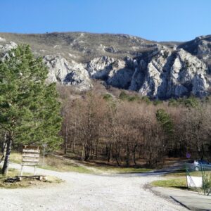
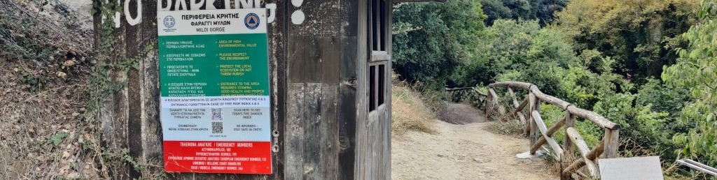
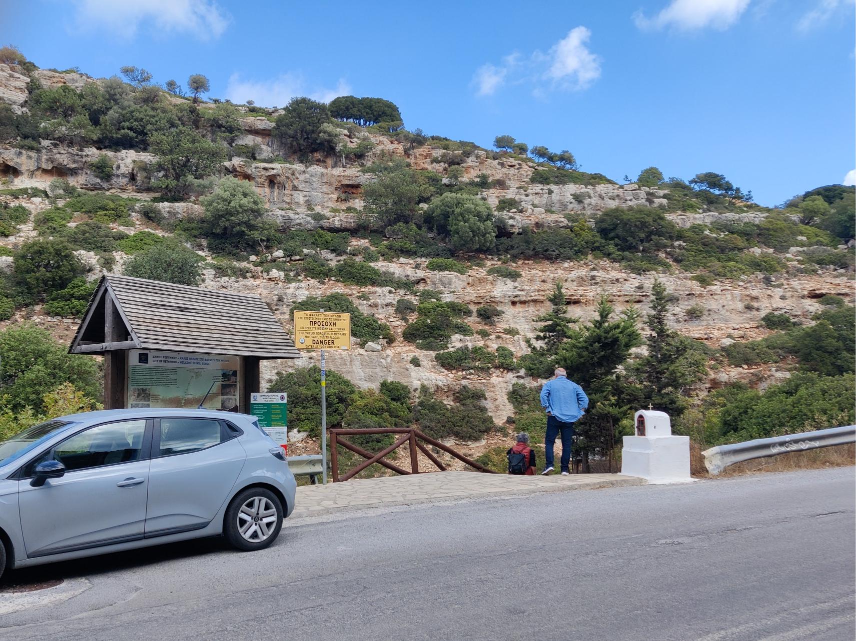
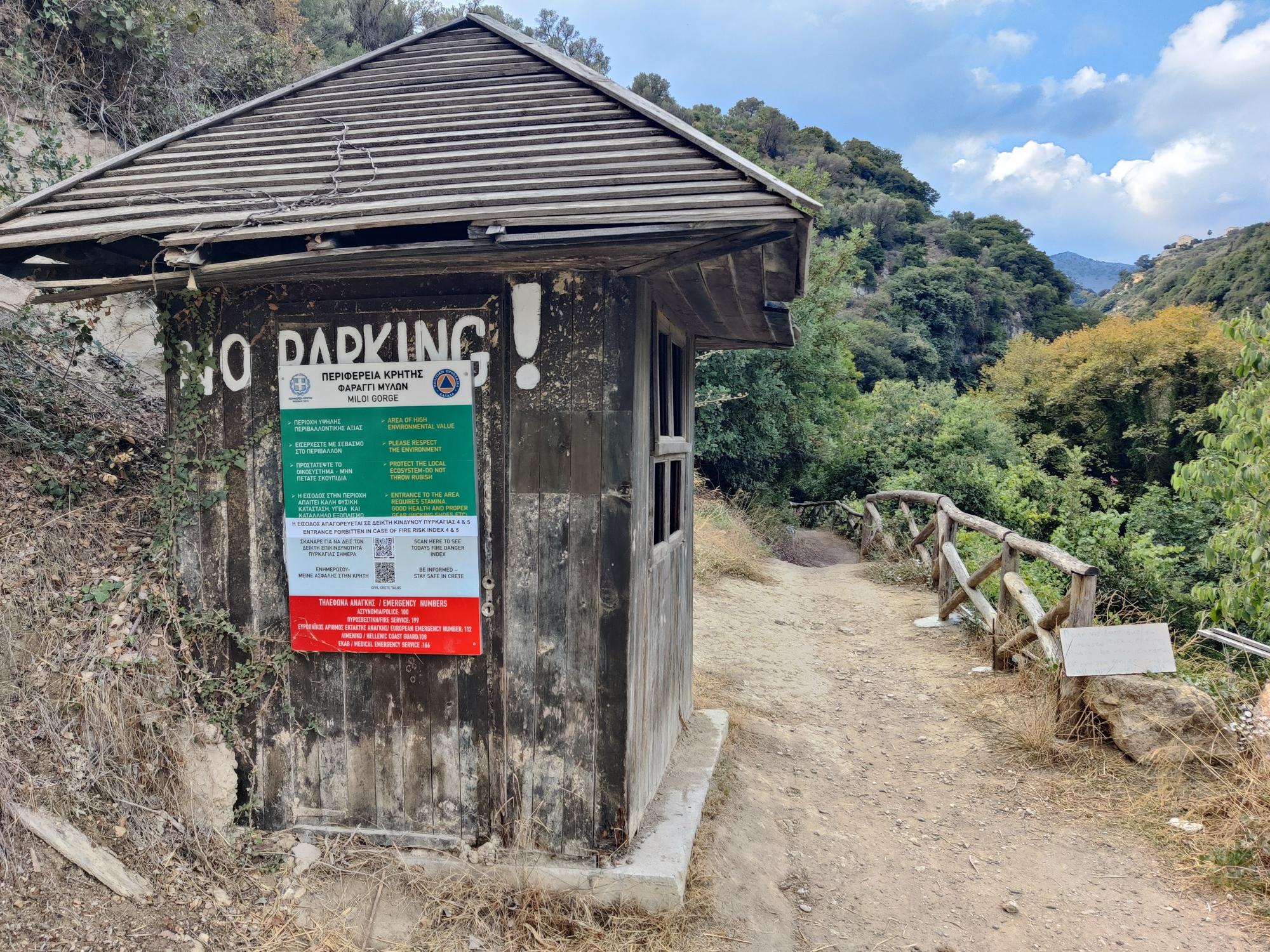
After approximately 1.7 kilometers the asphalt road turns into a gravel road which descends slightly before reaching the village. Here you cross a small stream and soon come back onto asphalt again. Shortly afterwards you arrive at the official entrance to the Myli Gorge trail. There is a small information hut with useful information about fire danger, emergency numbers and trail conditions.
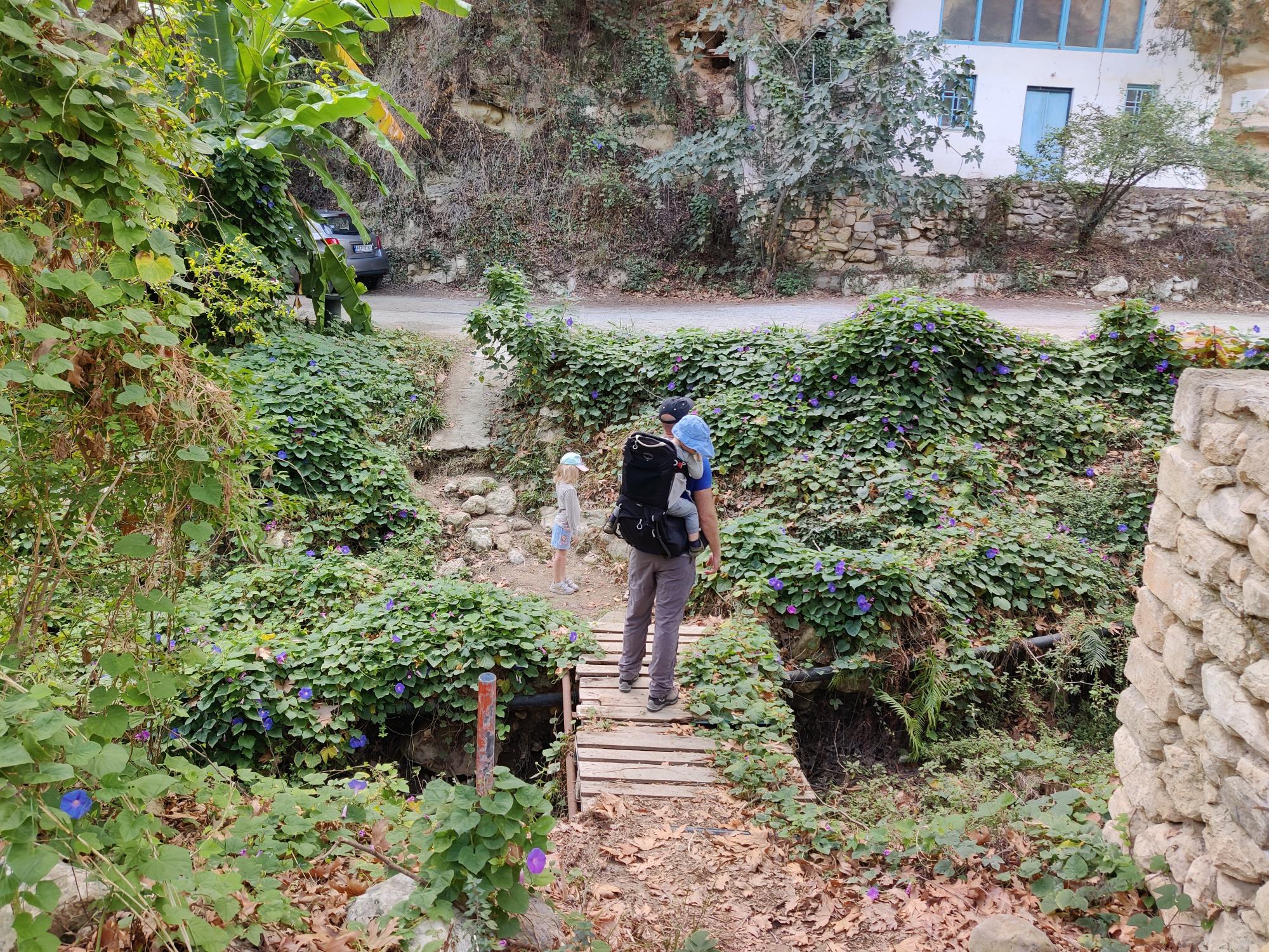
Myli Gorge Hike: Crossing the small stream and entering Xiro Chorio
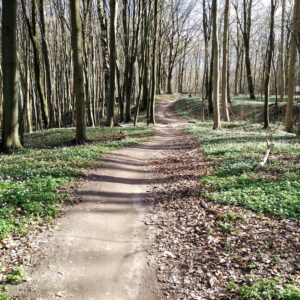
From here on the character of the hike changes completely. The trail narrows considerably and begins descending into the gorge itself. Good hiking footwear becomes essential at this point because the terrain is uneven, rocky and occasionally muddy. Even in October the gorge felt noticeably cooler than the open valley around it. We were wearing long sleeves while hiking through the shaded sections.
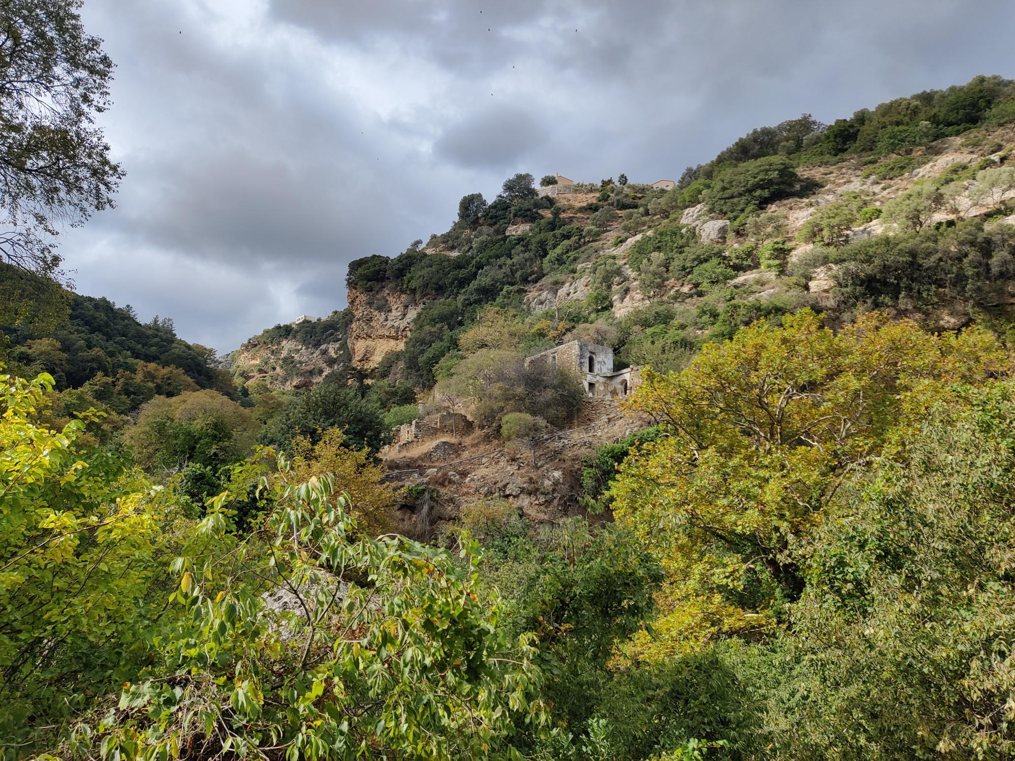
The gorge is incredibly atmospheric. The trail winds between steep slopes covered with dense vegetation while old, abandoned buildings occasionally appear along the path, reminding visitors that this area was once an important milling center for the surrounding villages.
However, we also learned an important lesson during this hike: do not bring a stroller into Myli Gorge. Since we were hiking with two small children, our youngest stayed comfortably in the Osprey Poco child carrier backpack while we brought a stroller in case our older child became tired. Unfortunately, for almost three kilometers through the gorge we had to carry the collapsed stroller over rocks, muddy stretches and narrow passages. It became a proper workout and significantly slowed us down. Families with small children are much better off using only a child carrier backpack here.
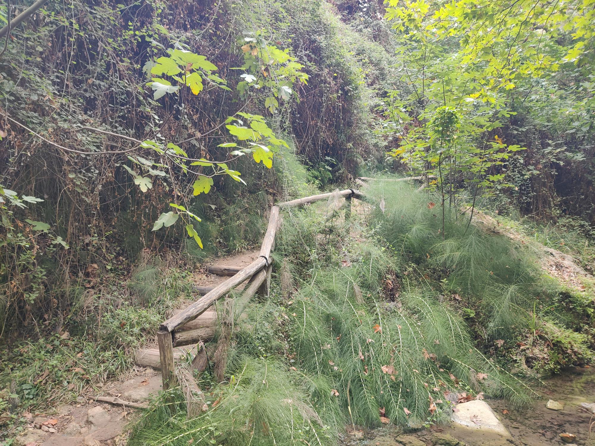
Myli Gorge Hike: The trail is quite narrow
The trail through the gorge itself measures roughly three kilometers. Several sections are steep and slippery, especially after rain, but none are truly dangerous if you move carefully. After approximately 5.5 kilometers in total, we decided to exit the gorge earlier than originally planned and ascend towards the main road leading to Chromonastiri. It is possible to continue another 500 meters or so through the gorge before exiting higher up, but by that point we were already exhausted from carrying both equipment and children.
Once out of the gorge, the final stretch follows an asphalt road uphill towards Chromonastiri. Although walking on asphalt is never my favorite part of a hike, the surrounding scenery remained pleasant with beautiful views over the hills south of Rethymno. The road is also not particularly busy.
Myli Gorge Hike: We exited the gorge here and continued towards Chromonastiri on the road
Chromonastiri itself turned out to be a charming mountain village with traditional stone houses and a peaceful atmosphere. We rewarded ourselves with lunch at Tavern Athivoles where we enjoyed delicious local food served by very friendly staff while several cute cats wandered around the tables hoping for snacks.
After lunch we briefly visited the area around the Military Museum of Chromonastiri. Unfortunately, we didn’t have enough time to enter the museum itself because we had to catch the bus back to Rethymno, but we still checked out the military vehicles displayed outside the building which the kids found quite fascinating.
Overall, this hike turned out to be a fantastic combination of nature, culture and local village atmosphere. It is especially suitable for travellers staying in Rethymno without a car, as both the start and end points are accessible by public transport.
Photo Gallery
Myli Gorge Hike: The start of the official Myli Gorge Trail
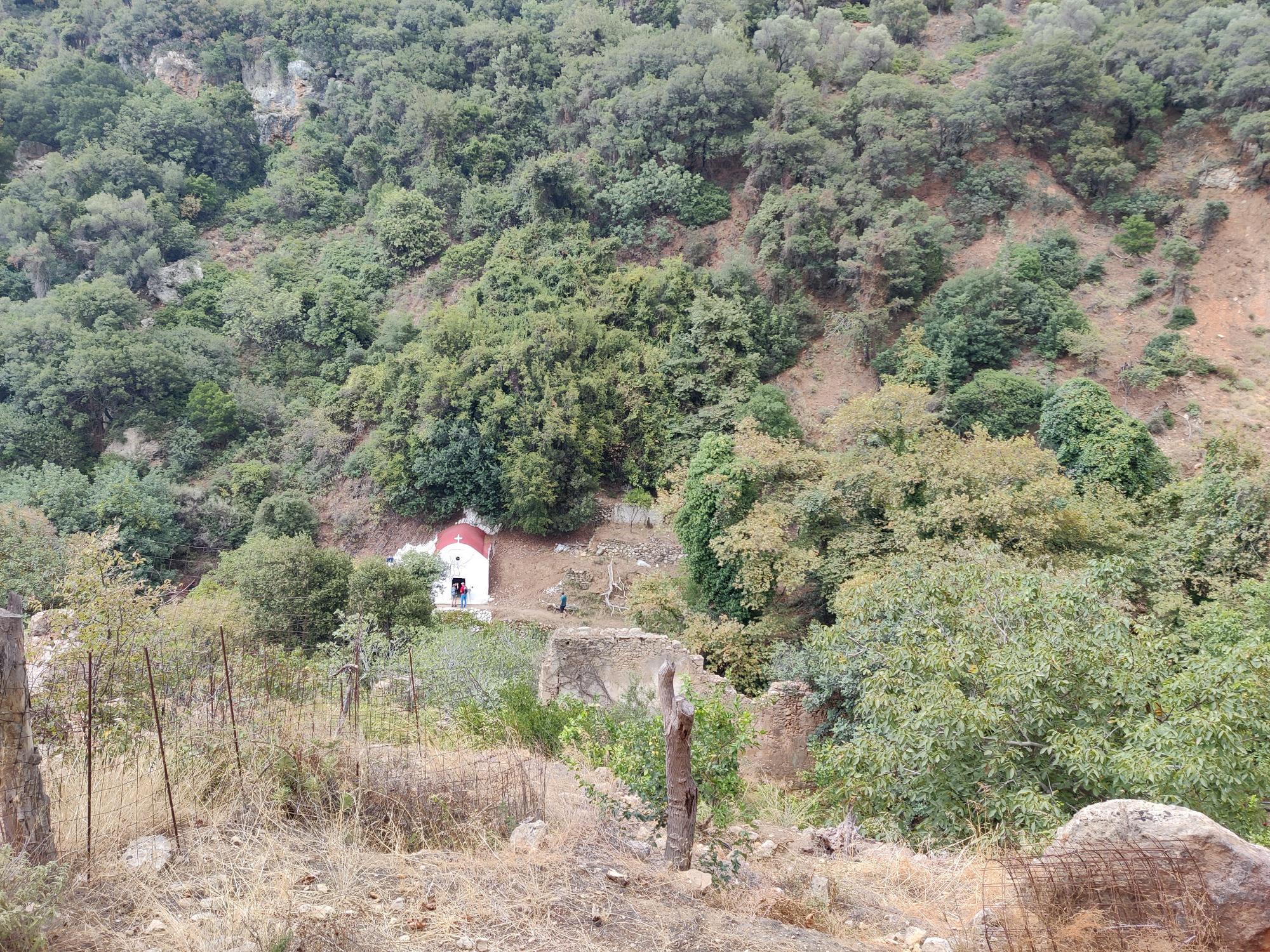
Myli Gorge Hike: A small church in the gorge
Myli Gorge Hike
Equipment
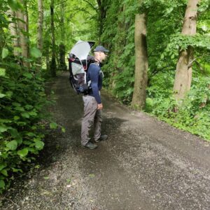
For this hike I wore wore Montane Terra Pack pants together Falke Cool base layer, while carrying our youngest child in the Osprey Poco child carrier pack. My wife carried most of our supplies in the Camelbak Rim Runner backpack. It got a bit cold in the gorge and there I also put on my Isobaa long sleeve zip neck.
Equipment under scrutiny
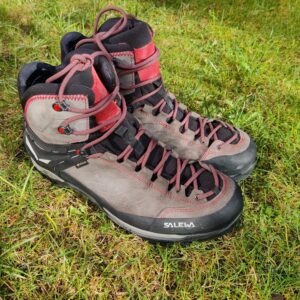
Salewa Mountain Trainer 2 Mid GTX Hiking Boots
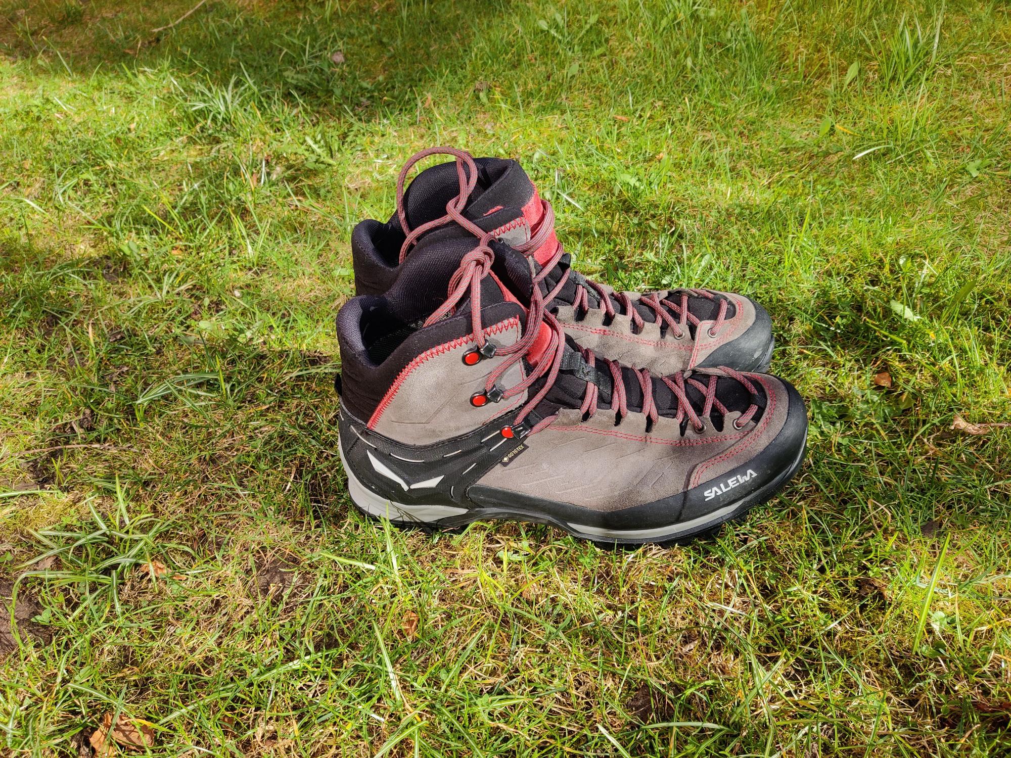
Salewa Mountain Trainer 2 MID GTX: A technical hiking boot, perfect for rocky terrain
The Salewa Mountain Trainer 2 Mid hiking boots turned out to be an excellent choice for the varied terrain in Myli Gorge. The boots provided very good ankle support while carrying a child carrier backpack and also handled the slippery sections in the gorge confidently. Despite the warm Mediterranean climate, the breathable construction kept my feet reasonably comfortable throughout the hike.

Conclusion
The Perivolia – Myli Gorge – Chromonastiri hike was one of the highlights of our stay in Crete. It perfectly demonstrated that the island offers much more than beaches. Within only a few hours we experienced olive groves, shaded canyon landscapes, abandoned mills and a beautiful traditional mountain village, all accessible by public transport from Rethymno.
The trail is also suitable for families with kids, provided that you are used to walking moderate distances and ascents. Proper hiking footwear is definitely recommended due to slippery sections and uneven terrain inside the gorge. Over the distance of 8.6 kilometers the trail ascends approximately 470 meters and reaches the highest point of 367 meters above sea level. We completed the route in a little less than four hours, including short breaks.
If you have any questions about this hike, please drop me a line in the comments below.