Tre Cime di Lavaredo
About Tre Cime di Lavaredo Trail
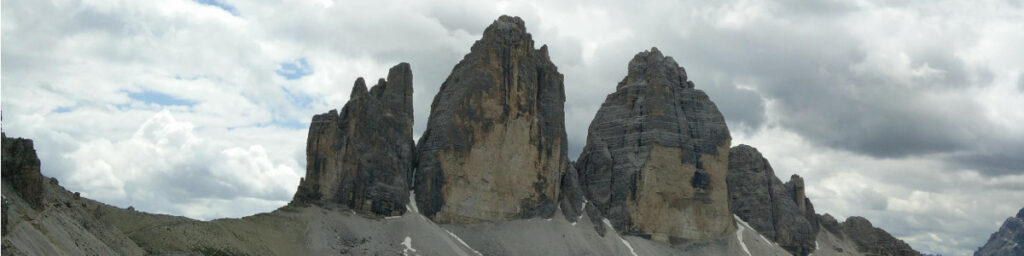
In the summer of 2019, we went for a hiking-packed holiday to the beautiful Dolomites in northeastern Italy. Our last hike went to the popular Tre Cime di Lavaredo national park which holds a small but impressive massif of three peaks that almost looks like an enormous fossilized fortification. The conspicuous peaks are the symbol of the Dolomite UNESCO World Heritage site. There are various paths around Tre Cime but the most popular encircles the three peaks while passing by four mountain huts which all offer food and drinks – Rifugio Auronzo, Rifugio Lavaredo, Drei Zinnen Hutte (‘Three Peaks Hut’) and Malga Langalm (‘Langalm Hut’).
We started at Rifugio Auronzo and circled the massif counterclockwise by walking along the southern mountain wall towards east. Navigation should generally not be a problem as the trail is popular and marked with signposts here and there. In any case you are welcome to download the GPS trail we made below and use it on your GPS device or watch to navigate the route. You can only enter the national park through a pay toll where all motorized vehicles have to pay a fee for entering and parking – see more below.
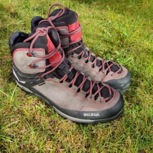
The starting point of the trail is at the parking area at Rifugio Auronzo. The trail is suitable for all able-bodied wearing good hiking boots as an absolute minimum. We also recommend you to be dressed for lower temperatures and bring a rain jacket in case of a sudden weather change on the trail – we experienced it more than once. It might also be smart to bring thin gloves and a hat as the sharp gusts of wind can be quite cold.
Tre Cime di Lavaredo Trail Details
Physical Difficulty
Medium
Technical Difficulty
Medium
Duration
4 h 52 min
Distance
10.52 km
(6.54 mi.)
Ascent
369 m
(1211 ft.)
Descent
380 m
(1247 ft.)
Highest Point
2451 m
(8041 ft.)
Lowest Point
2185 m
(7169 ft.)
Date of the Hike Date when we did this hike ?
July 2019
Weather On the day when we did this hike ?
Partly cloudy
Temperature On the day when we did this hike ?
10° C
(50° F)
Wind On the day when we did this hike ?
25 km/h
Warning!
This trail has a few steep sections and requires good footwear, steady footing and no fear of heights.
Tre Cime di Lavaredo GPS Route and Trail Description
*Click on the chart to see the location on the map
GPX route helps you with the navigation on a hike. It can be used with a smartphone, handheld GPS device or a GPS watch.About GPX Route
Reaching the starting point
When heading for the parking area at Rifugio Auronzo, you should first aim for the incredibly picturesque lakeside village of Misurina. Misurina can be reached from the northwest (Brunico/Bruneck, Bressanone/Brixen etc.) by following the state highway (stradale statale) SS51 to the small town Carbonin/Schluderbach where you will go towards southeast on Via Monte Piana (SS48bis) which turns into the provincial road SP49. When you reach a medium-sized parking lot at the B&B L’Albergo Dolomiti des Alpes, you should soon take rather sharp left (almost a U-turn!) to go on the local road towards Rifugio Auronzo and Tre Cime. Don’t worry about missing it– it literally writes “Tre Cime” and an arrow to the left on the SP49 before you have taken the sharp left.
*Once on the local road towards Rifugio Auronzo and Tre Cime, you simply follow it for a little more than 7 kilometers to the end. After approximately 3 kilometers of driving, you will come to the pay station for entering the national park. Expect to be in a queue for paying for a little while, depending on the time you arrive. When you finally arrive to the huge parking lot at Rifugio Auronzo, you will probably be directed/guided to a specific parking place by the parking employees in fluorescent vests. Your designated place of parking will also be determined by the type of vehicle you’re driving.
You can also reach Misurina from the southwest (Cortina d’Ampezzo) or southeast (Lozzo di Cadore, Santo Stefano di Cadore). In both cases you should aim for the regional road SR48. From Cortina you will drive approximately 13 km on the meandering SR48 towards northeast before you come to a T-junction, where you should turn left onto the provincial road SP49 (to the right, SR48 continues towards southeast). Follow SP49 through Misurina next to its lake; a few hundred meters after the road has stopped following the lakeside, you have to turn right onto the local road towards Rifugio Auronzo and Tre Cime. Don’t worry about missing it– it literally writes “M. Piana Tre Cime” and an arrow to the right on the SP49 before you have to turn. Then follow instructions for the local road ahead as above (marked *).
In the southeast the SR48 sets out just before the picturesque lake Lago di Santa Catarina and runs for about 25 kilometers before it turns into SP49 at the T-junction mentioned above, meaning that you should just continue straight ahead (if you go left, you will follow SR48 to Cortina). Follow SP49 through Misurina and follow instructions as above.
If you are not travelling by car or don’t want to pay the 30 euros (33$) entry fee to the national park for cars, there is also possibility to reach the starting point by bus from Misurina or bigger cities like Cortina or Belluno. This is, however, only possible in the summer season which usually runs from mid-June to mid-September. To find a route which suits you, check the seasonal busses (linee stagionali) on dolomitibus.it.
Trail
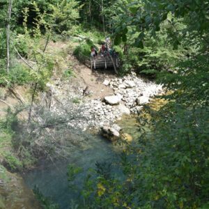
Your hike starts at the parking lot below Rifugio Auronzo. It is a quite wide-spread area, but in any case, you should head up towards the Rifugio Auronzo mountain hut. On the way you might pass by the public toilets which are built into the cliff itself. They are free of charge, unlike the other toilets on the trail, so do use the opportunity here in case you hear the call of nature. The GPS trail attached above (free to download) starts approximately 50 meters from the mountain hut. Soon after you pass the mountain hut, the asphalted road ends and you should take a sharp turn onto the wide dirt road towards north. Soon after the dirt road turns towards east. This part of the trail might be quite busy with hikers going in either direction, but as it is wide and relatively flat you should not suffer any greater perils than having someone photobombing your panorama shot.
After following the dirt road for a kilometer, you will come to a small chapel called Cappella degli Alpini which has been built in memory of fallen soldiers in the area during the First World War. Soon after you will see several small paths diverging off to the right from the dirt road, but you should continue on the dirt road which starts running north again. After hiking a little less than two kilometers you will reach the mountain hut Rifugio Lavaredo where you can get drinks and hot food. We only made a short stop here to admire the southern side of the three magnificent peaks. At the mountain hut the dirt road divides into two smaller dirt tracks – you should choose the easternmost which at first runs almost directly north. Now, the trail starts ascending more abruptly and soon bends east. After a few hundred meters the path divides again but a signpost will direct you towards the Drei Zinnen Hutte to the north.
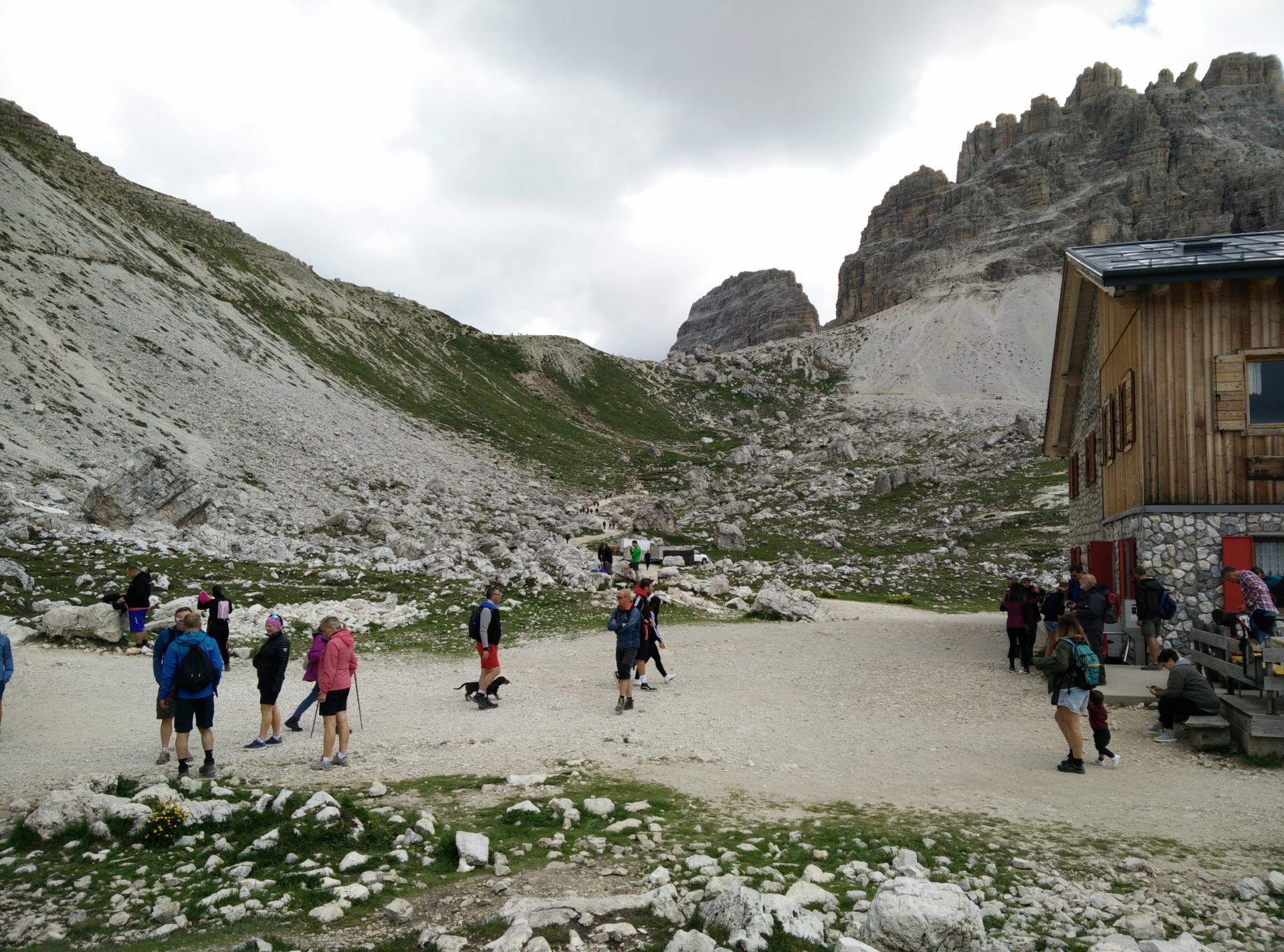
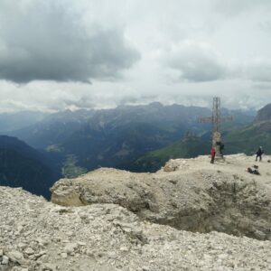
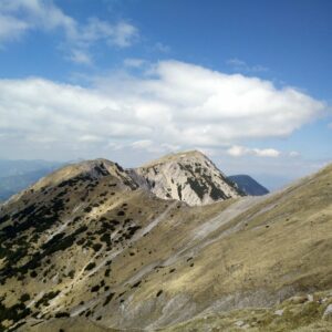
You will then work your way up to the highest point of the trail – the Forcella Lavaredo (literally ´the Lavaredo Fork´) on the same ridge as the three peaks, at the altitude of 2450 meters after having hiked a little less than three kilometers altogether. From here the main path descends towards northeast, but there are also several side paths running directly under the three peaks towards west (and the Malga Langalm mountain hut) which we (I) were tempted to take. However, we (he) wanted to stick to the main path going to the Drei Zinnen mountain hut – a path which descends more or less gently for about a kilometer and then ascends abruptly over a distance of 500 meters. At the mountain hut we made a longer stop for eating our packed lunch and buying some hot drinks. The toilet is free of charge for customers. Behind the mountain hut you will also find a small church called Chiesetta Alpina and two small lakes called Laghi del Piani further below.
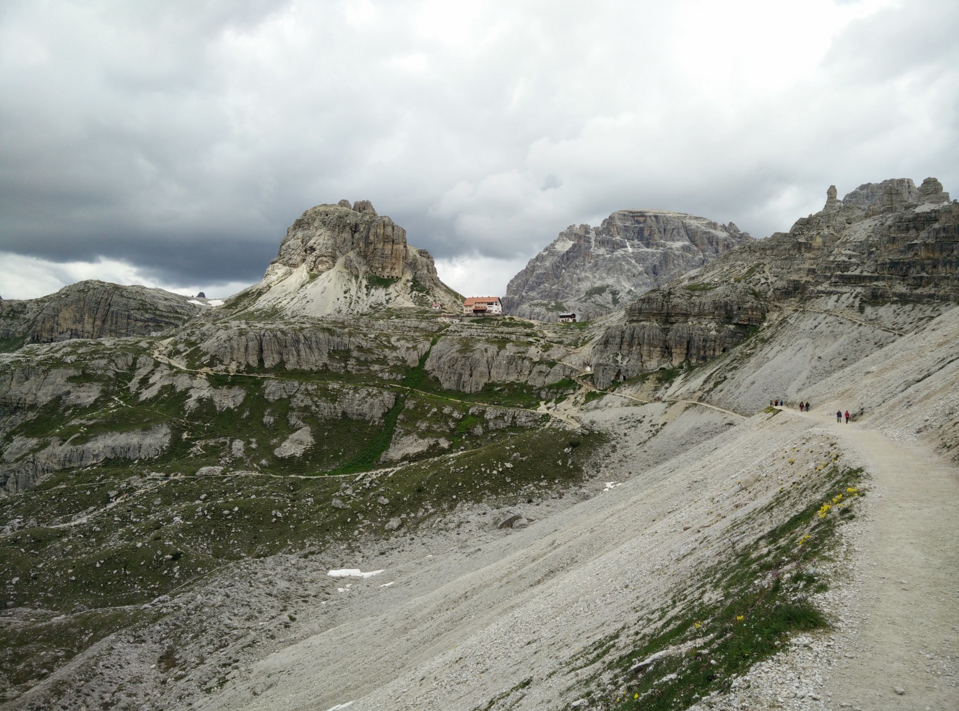
Rather than descending down the same route that we used to come up to the mountain hut from the main path, we chose to descend the western way around the mountain hut. There are several paths on the slope but if you follow sign posts towards the Malga Langalm mountain hut you should end up in the right direction. In comparison to the first five kilometers of the trail, the terrain is greener here with larger patches of moss and delicate alpine flowers. After descending for two kilometers more or less towards south from the Drei Zinnen mountain hut, you come to a small green valley; from here onwards you will only be ascending. There are also next to none ‘unofficial’ side paths to lead you astray, so you can just focus on enjoying the beautiful landscape on your ascent heading southwest towards Malga Langalm. You will reach it after hiking about eight kilometers altogether.
We only made a brief stop to hydrate and otherwise kept our eyes on the magnificent northern wall of the Tre Cime. At Malga Langalm you will also see that the alternative path from the Forcella Lavaredo (which I was tempted to take) ends here. After the mountain hut the trail ascends towards south for about a kilometer until you reach the ridge of the three peaks, which is called Forcella del Col de Medo on this side. From there the path turns towards southeast, and following it, you have less than one kilometer of distance back to the parking area at Rifugio Auronzo.
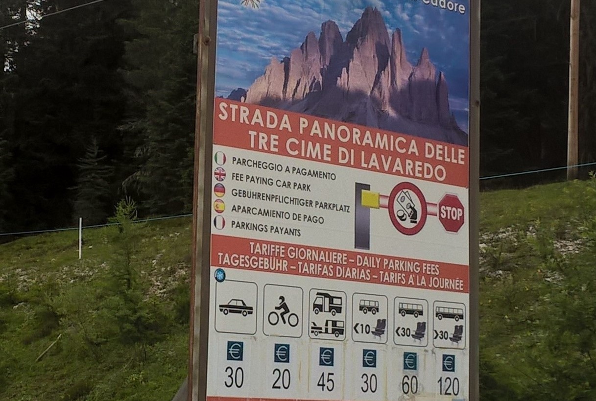
Tre Cime di Lavaredo: Road toll depends on type of your vehicle
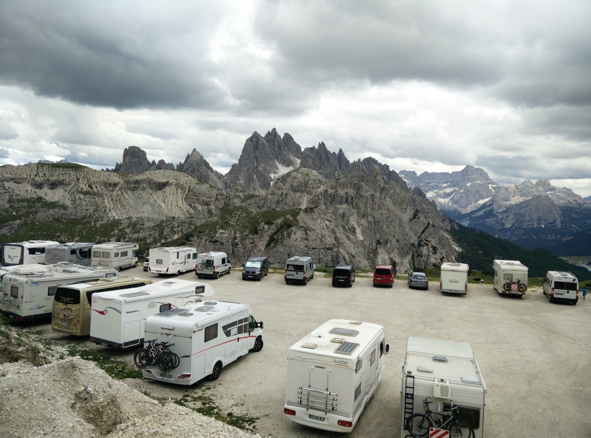
Tre Cime di Lavaredo: The parking place at Rifugio Auronzo
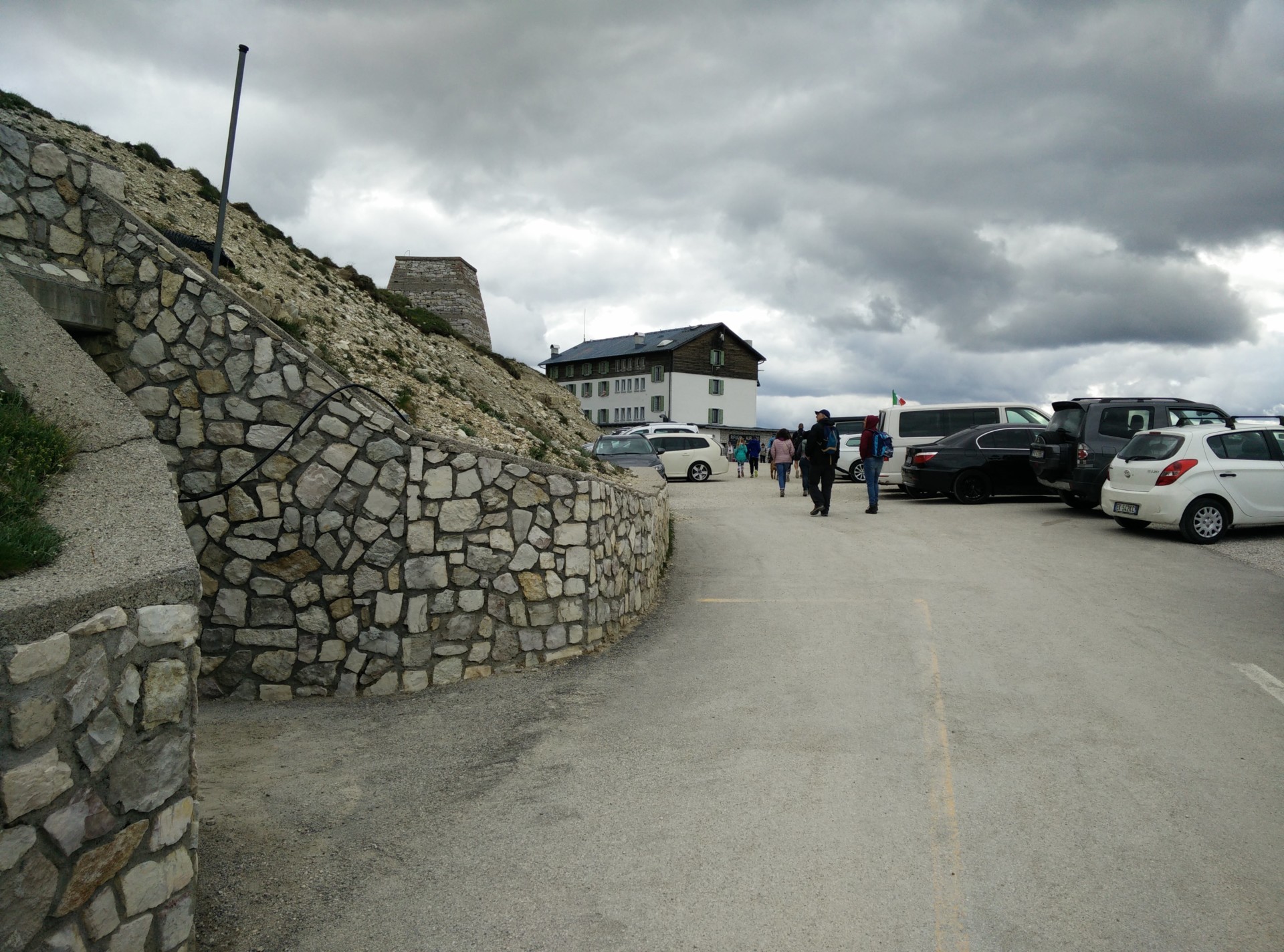
Tre Cime di Lavaredo: Toilet on the left, rifugio Auronzo behind
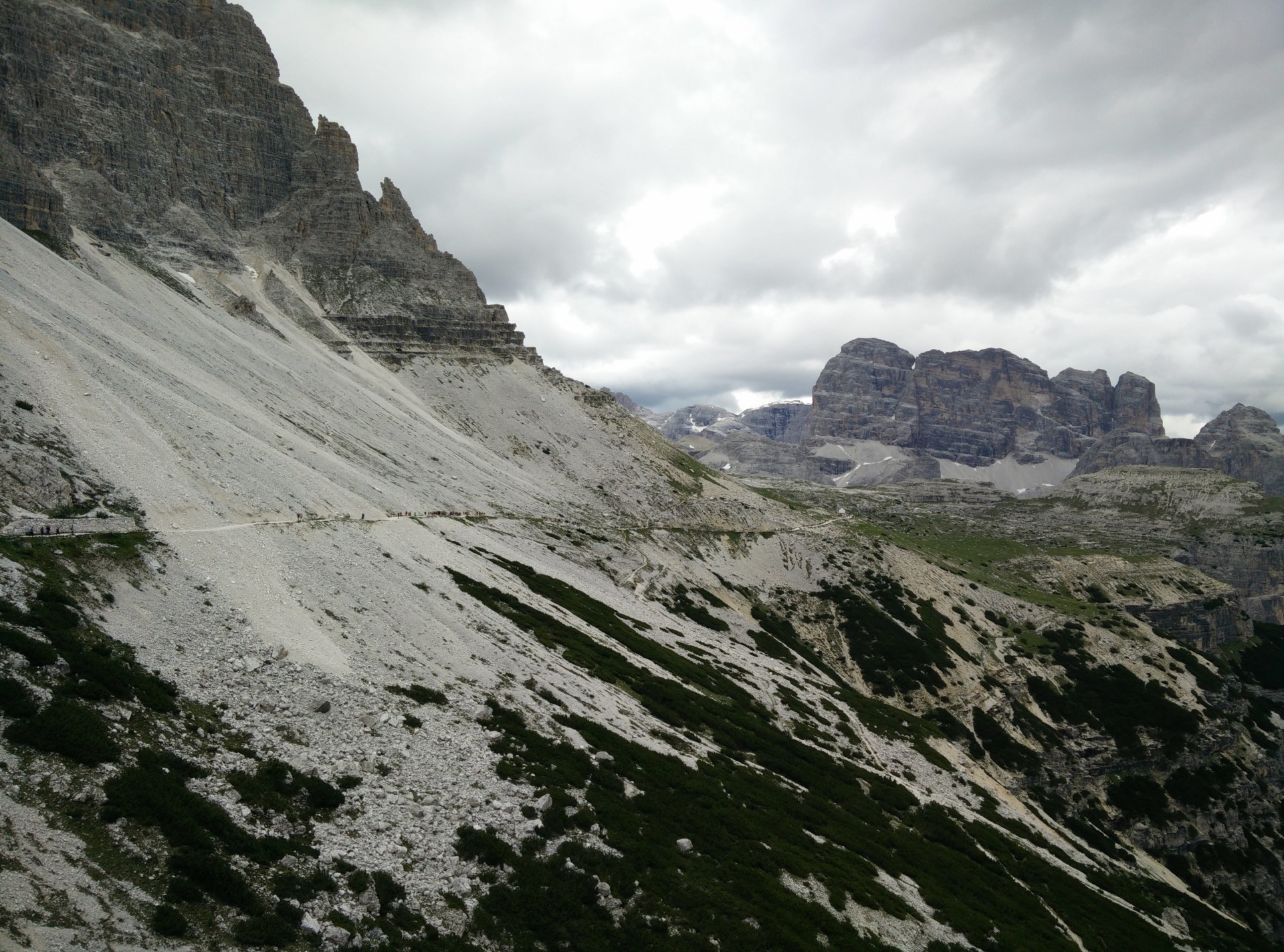
Tre Cime di Lavaredo: Path from Auronzo hut towards Lavaredo hut
Tre Cime di Lavaredo: Rifugio Lavaredo, here the path starts ascending rapidly
Tre Cime di Lavaredo: Hiking from Lavaredo hut towards Drei Zinnen hut, the Drei Zinnen hut is seen
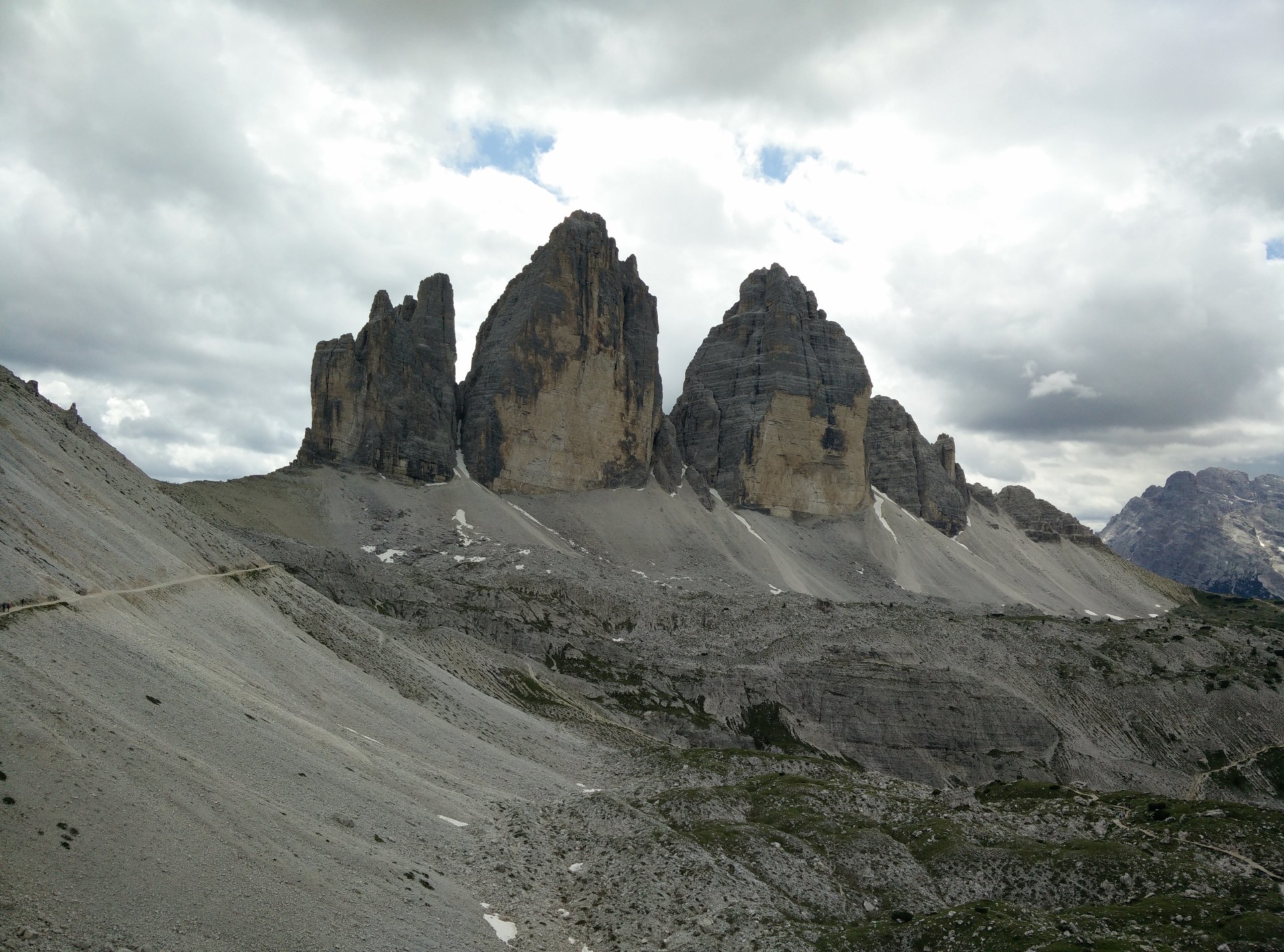
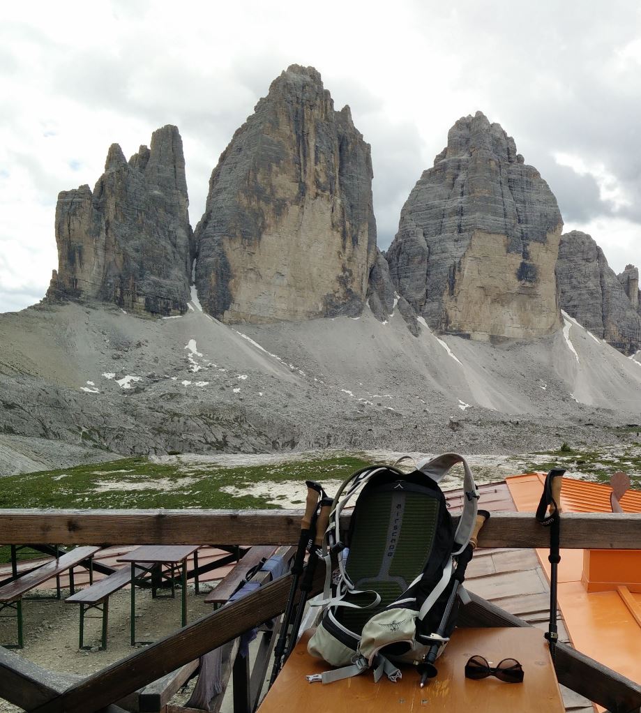
Tre Cime di Lavaredo: View on the three peaks from beneath Drei Zinnen hut
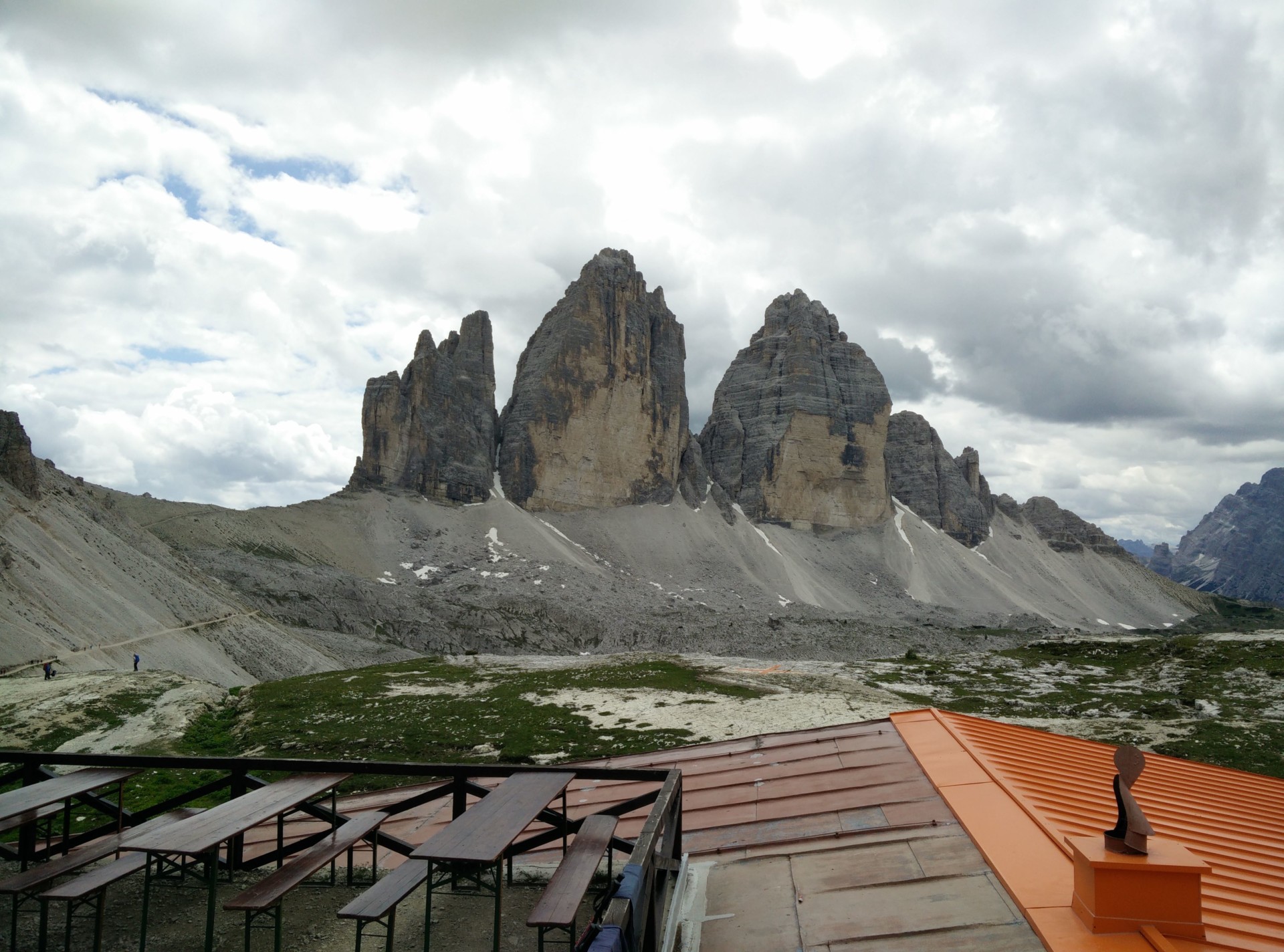
Tre Cime di Lavaredo: Sun deck at the Drei Zinnen hut
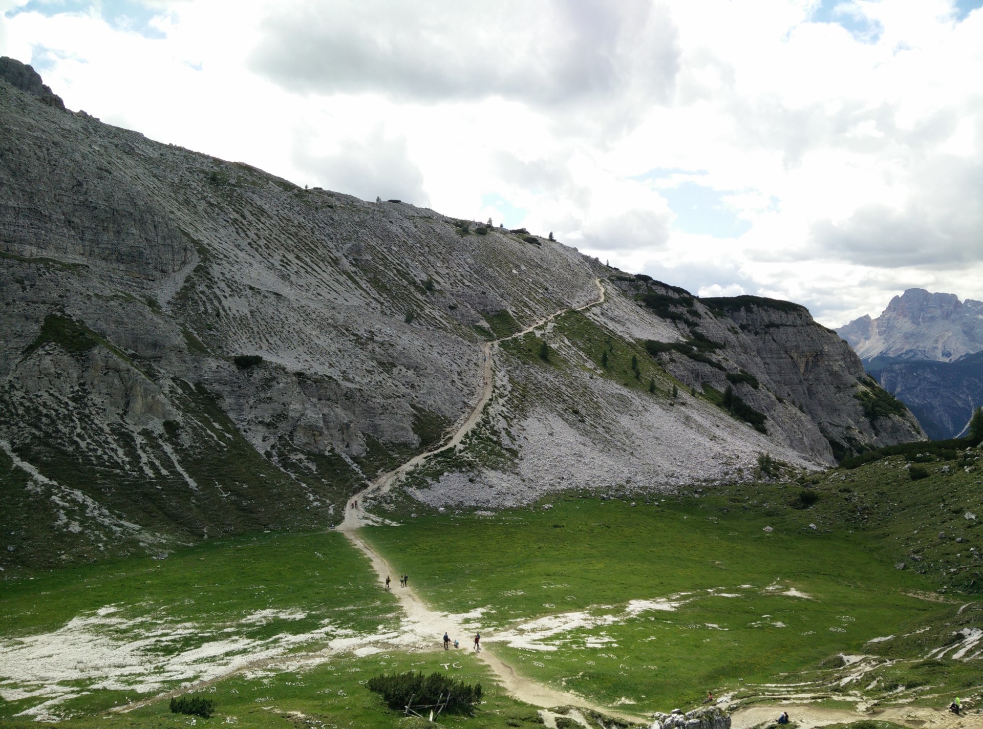
Tre Cime di Lavaredo: Green valley after which the trails ascends
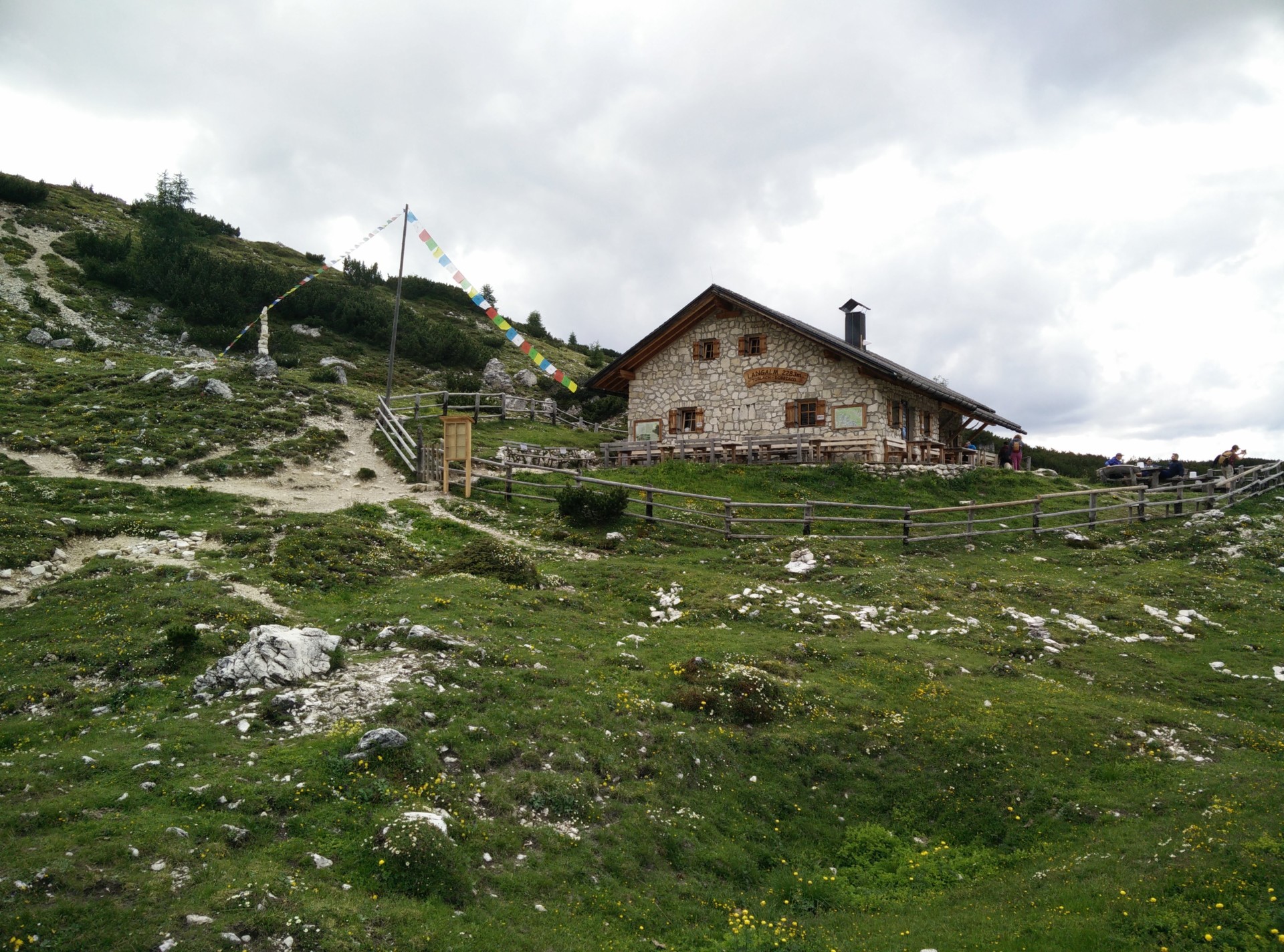
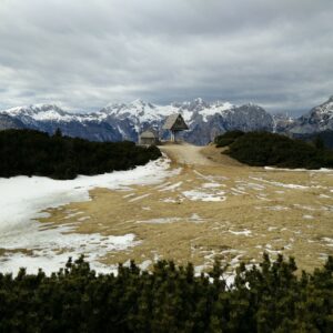
Tre Cime di Lavaredo: Malga Langalm mountain hut comes after Drei Zinnen hut
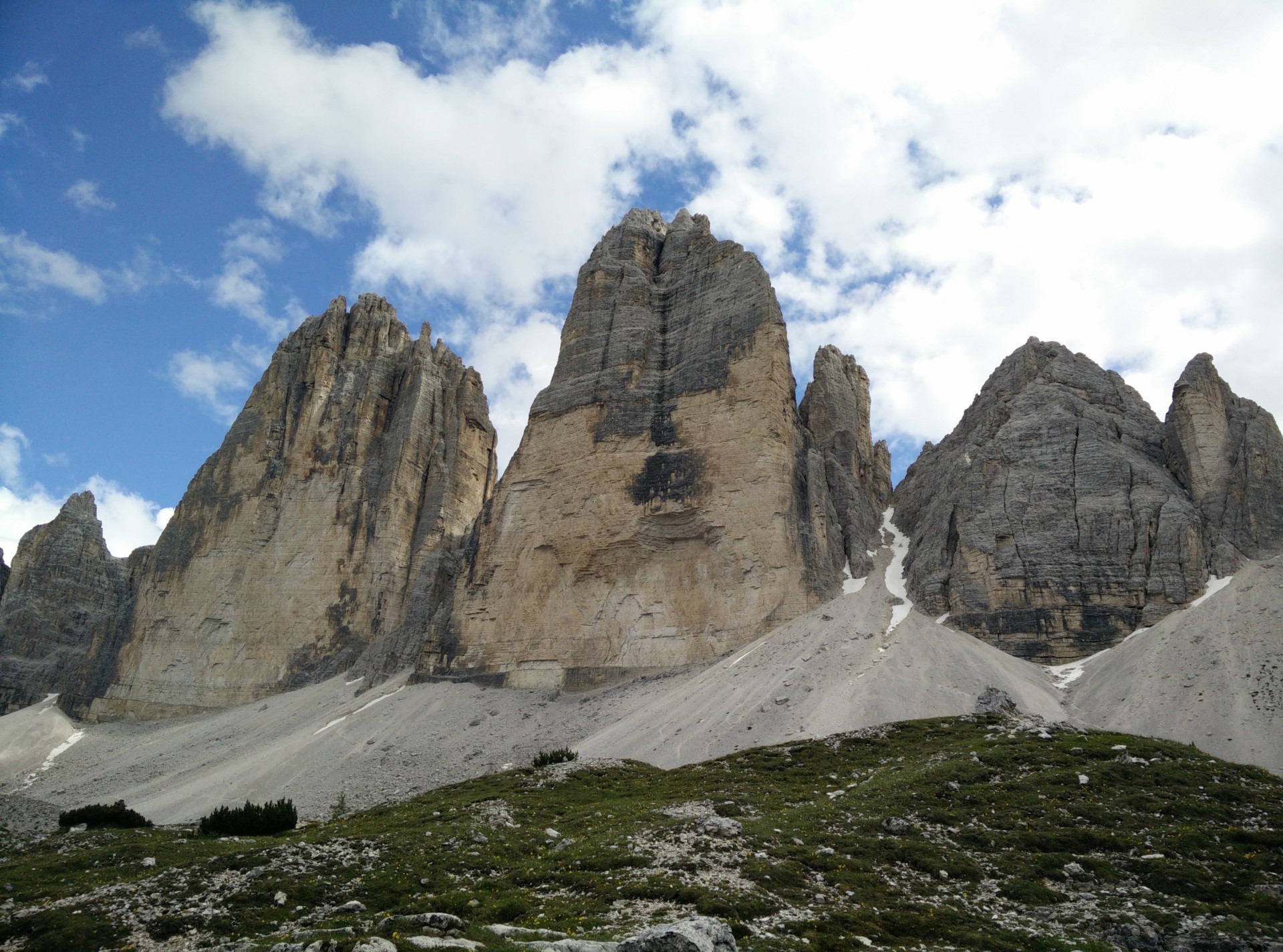
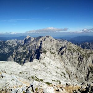
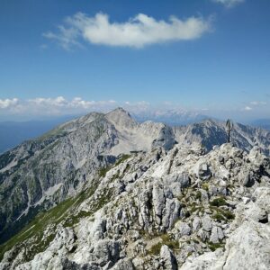
Tre Cime di Lavaredo: The three peaks from north-east
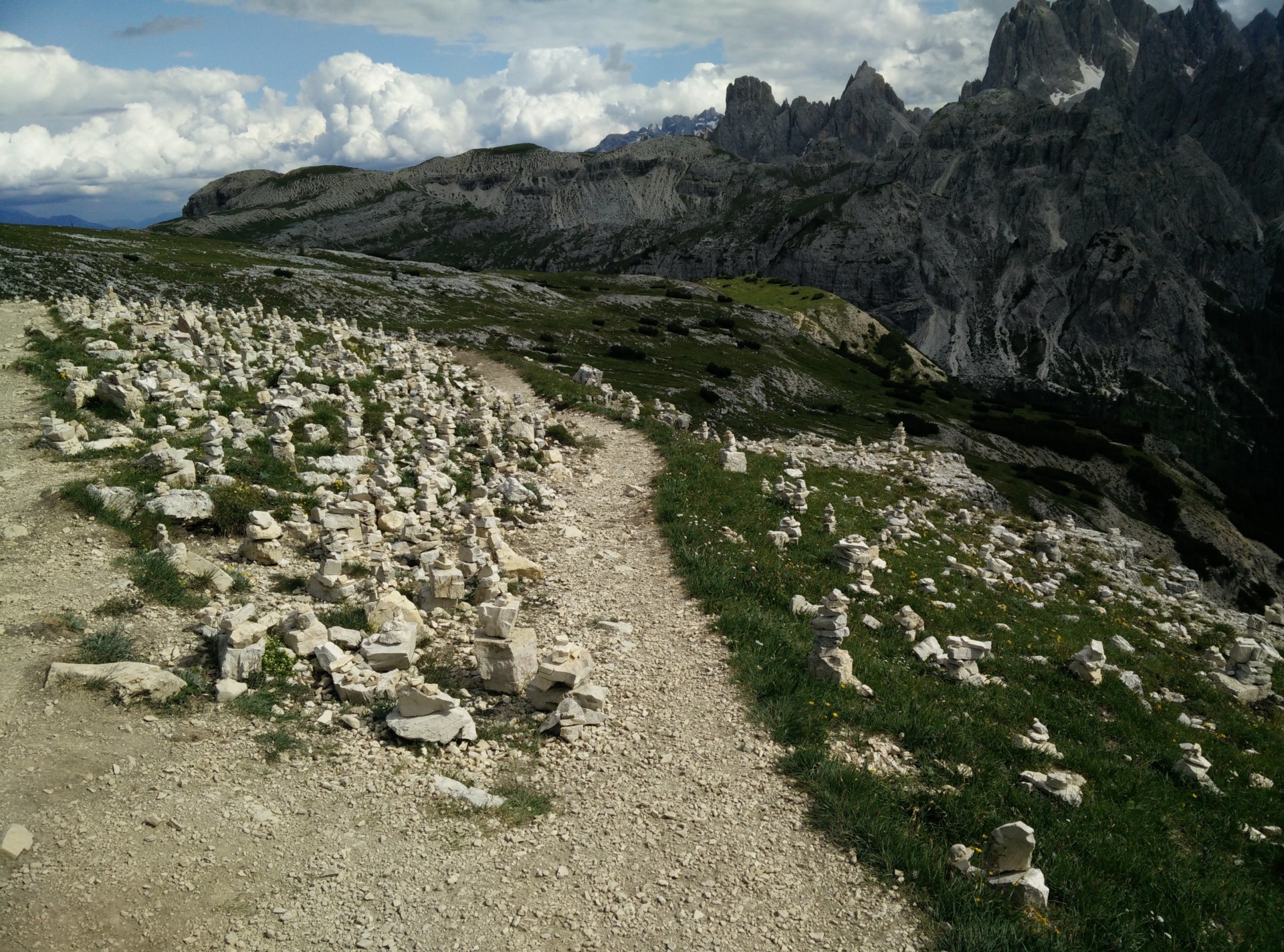
Tre Cime di Lavaredo: Stone sculptures on the last stretch
Equipment
Besides my Scarpa Marmolada boots, I was wearing the Falke Silk-Wool t-shirt and underwear under hiking pants and a long-sleeved Merino base layer. We had quite mixed weather during the hours on the trail, so I also had to use my rain jacket a couple of times.
Equipment under scrutiny
Falke Silk-Wool T-Shirt and Underwear
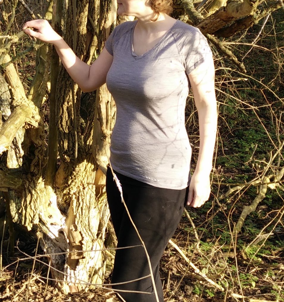
Falke Silk-Wool T-shirt Front
As the weather on the trail gave us rain, sun as well as chilly gusts of wind I was really happy with the Silk-Wool fabric’s ability to keep me warm when it’s cold and cool when it’s warm. The latter was especially an issue at the time as I was six months pregnant and often got inexplicably hot from the waist up. But even when I soaked the t-shirt with sweat, the anti-microbial properties of the fabric would keep it odor-free. You can read the full review of the Falke Silk-Wool T-Shirt and the underwear here.
Conclusion and photo gallery
The trail around Tre Cime di Lavaredo is appropriate for all ages. If you are in good shape, you can probably do the trail in less than 2 hours as the ascent is moderate, but we recommend that you take your time, enjoy the views and stop in at least one mountain hut for a drink or a meal on the terrace.
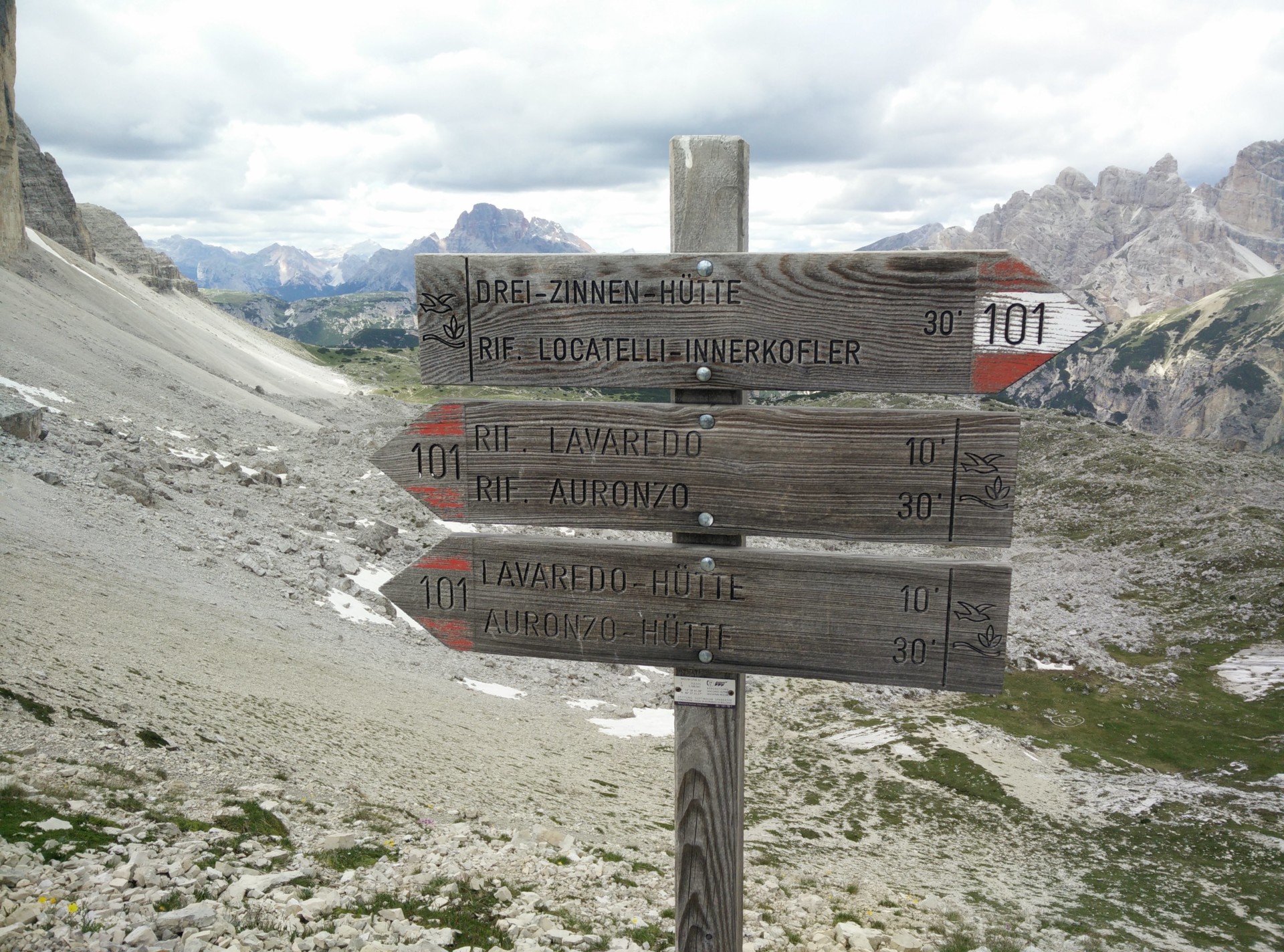
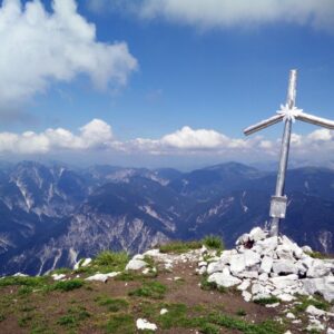
Tre Cime di Lavaredo: Signpost at Forcella Lavaredo
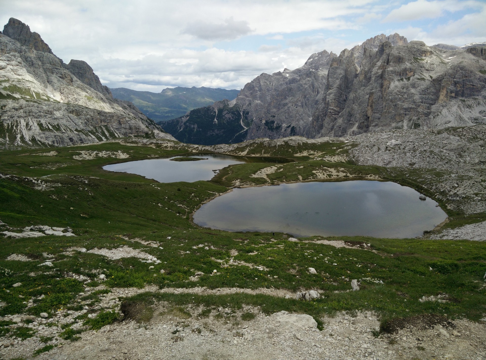
Tre Cime di Lavaredo: Laghi del Piani behind the Drei Zinnen hut
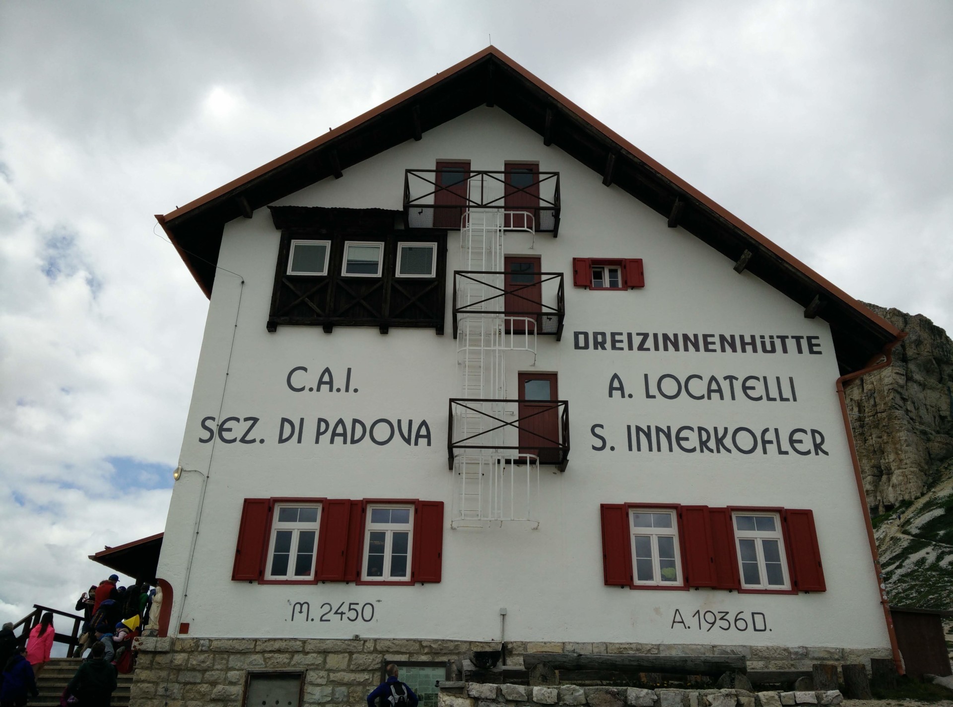
Tre Cime di Lavaredo: Drei Zinnen Hut
Tre Cime di Lavaredo
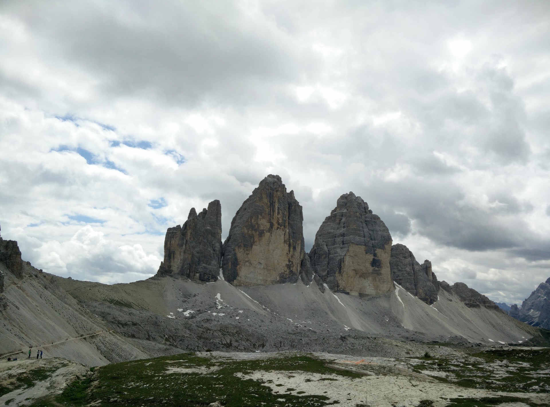
Tre Cime di Lavaredo: Peaks
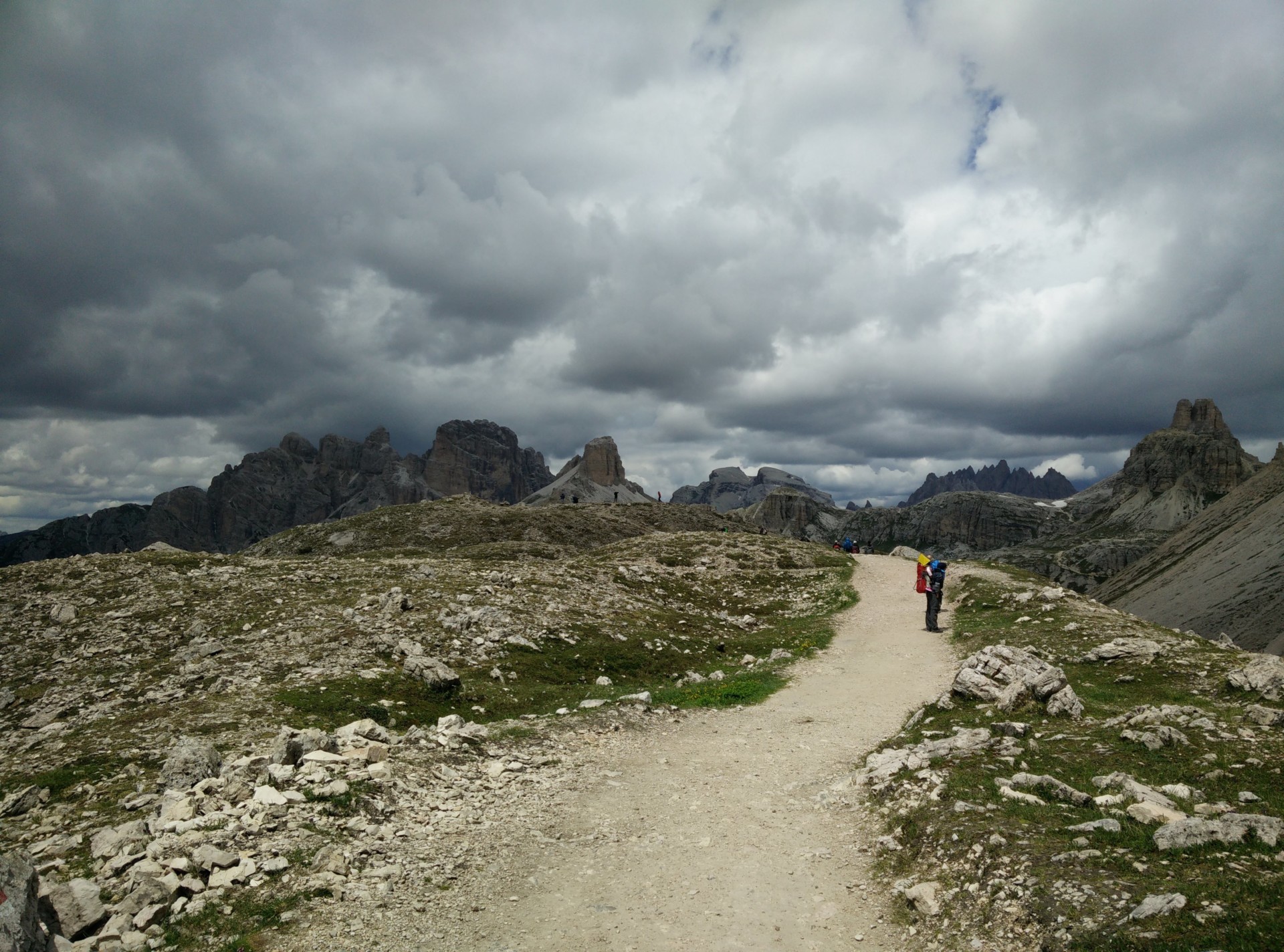
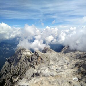
Tre Cime di Lavaredo: Weather was changing super fast
If you have any questions about this hike, please drop me a line in the comments below.
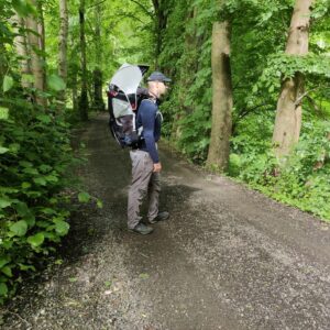


If someone wanted to do this as a family outing with kids ranging from 8-3 would a stroller be allowed/ accessible on the trails?
Hi, we saw many families doing the hike alongside us! However, with a stroller you can only get from the parking place to the Rifugio Lavaredo (a bit less than 2 km); afterwards it gets too steep as you might be able to see on the height curve underneath the map of the trail. If your 3-year old isn’t too big, I’d recommend using a child carrier backpack to carry him/her. Good luck!