About the Mount Etna Hiking Trail
In October 2022 we went on our honeymoon to Sicily, Italy’s largest island, which is home to the notoriously active volcano Mount Etna. Already in Catania airport you will be flooded with commercials and options for guided trips to the mountain, but these are quite pricey, and we wanted to be able to walk at our own pace, with a 3-year old in tow (albeit in a child carrier backpack). Luckily, we found out that it is indeed possible to go to Mount Etna from Catania by public transport after a bit of research. Below we have written everything you need to know for going on your own adventure to Mount Etna.
There are various approach routes onto Mount Etna, but the most common is that starting from the mountain hut called Rifugio Sapienza, close to the town of Nicolosi at the southern end of the vulcano. At Rifugio Sapienza (1923 m) you have the option to take the cable car (Funivia) up to its terminal, called Terminal Funivia dell’Etna at about 2500 m above sea level. In the terminal building, there is a café, toilets, a gift shop and the possibility to rent appropriate gear for unprepared tourists wanting to continue the hike upwards (such as hiking boots and insulated jackets).
You can also walk on foot from Rifugio Sapienza and up to the other mountain hut, but that trail is supposedly boring and exhausting, so we decided to save on our energy for exploring the mountain from the cable car terminal and upwards. This is also the starting point of the enclosed GPX trail below. If you do decide to begin your hike already at Rifugio Sapienza, navigation should, however, not be a problem as you simply follow the path upwards, running more or less parallel to the course of the cable car line.
Mount Etna Hiking Trail Details
Physical Difficulty
Easy
Technical Difficulty
Easy
Duration
2 h 50 min
Distance
6 km
(3.73 mi.)
Ascent
299 m
(981 ft.)
Descent
268 m
(879 ft.)
Highest Point
2.728 m
(9 ft.)
Lowest Point
2.496 m
(8 ft.)
Date of the Hike Date when we did this hike ?
October 2022
Weather On the day when we did this hike ?
Partly cloudy
Temperature On the day when we did this hike ?
8° C
(46° F)
Wind On the day when we did this hike ?
20 km/h
Mount Etna Hiking Trail GPS Route and Trail Description
*Click on the chart to see the location on the map
GPX route helps you with the navigation on a hike. It can be used with a smartphone, handheld GPS device or a GPS watch.About GPX Route
Reaching Mount Etna from Catania by Public Transport
The Sicilian bus company AST(Azienda Siciliana Trasporti) operates the bus line from Catania to the Rifugio Sapienza. It departs once a day, at 8.15 a.m. from the AST bus stop in the middle of the huge roundabout next to the Catania train station. Getting your bus ticket and actually getting on the bus is, however, no small feat. In theory, you could buy your ticket online at astbus.it, but the web site was so buggy that we couldn’t make the actual purchase. Instead, you can buy the ticket in person at the Nafé café, which is on the corner between Piazza Papa Giovanni XXIII (aka the huge roundabout) and Via Don Luigi Sturzo. The ticket sale starts at 7.30 a.m. and we would strongly suggest that you get your ticket as early as possible, and then go to the bus to take your seat immediately.
If not, you might risk finding a full bus ready to leave without you, and have to argue forever with the café staff to get a refund. You can also buy your ticket in advance (with a specified date), but again we would advise you to be seated in the bus no later than 7.45 or so. A bus ticket does NOT mean a reserved seat, and yes, they might sell more tickets than there are actual seats in the bus, not least if someone magically manages to buy tickets online. Interestingly, there is an actual AST ticket office on Via Don Luigi Sturzo, but allegedly it first opens at 10 a.m. and some people have reported being redirected to the Nafé café for tickets to Etna. We arrived at the café shortly after 7.30 a.m. and there were already a line of 10 people buying tickets or coffee or both.
It took us about 10 minutes to get our tickets (6.60 euros for an adult return ticket, small children for free – age limit unknown), and we went straight to the AST bus stops, placed behind the small newspaper kiosk called Edicola Centre Stazioni, somewhat diagonally across from the Nafé café (20 meters of walking). Here we found three busses with Etna as the destination, two of them already alarmingly full. Our bus also filled up fast, and the bus departed already around 8 a.m. – yet another reason to come early. The bus departs when it’s full – not when it is scheduled to. The busses then drove for a bit less than an hour to Piazza Vittorio Emanuele in the small town of Nicolosi, just south of Mount Etna. Here, the driver went out without an explanation or telling when/if he would be back.
Most people stayed on the bus or just next to it, probably out of fear of being left behind, but after 20 minutes we needed a restroom, and eyed a café called La Dolce Vita a bit further up the road. You had to make a purchase at the café to use the restroom, but as it turned out to be an excellent bakery as well, we were not sorry for buying a delicious pistachio croissant. As we spotted our M.I.A. bus driver sitting and chatting at one of the café tables, we too felt confident to actually sit down at the café. Altogether, the break in Nicolosi lasted nearly 45 minutes, so we felt sorry for those not leaving the stuffy bus (without a toilet) at all. Still, we would advise people to have an eye on the driver if you leave the bus after him and stay in the near vicinity, even if he makes a clear declaration about when he will resume driving.
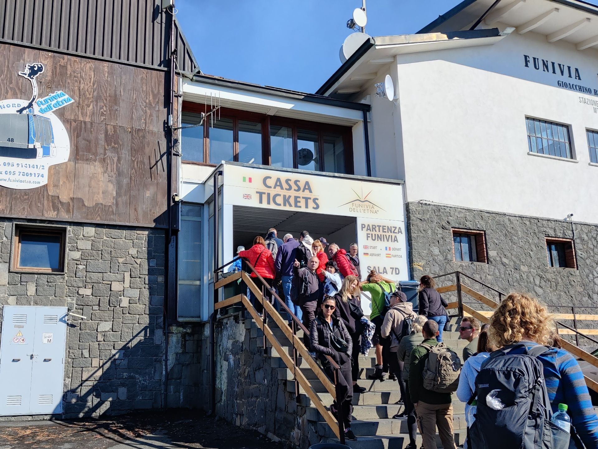
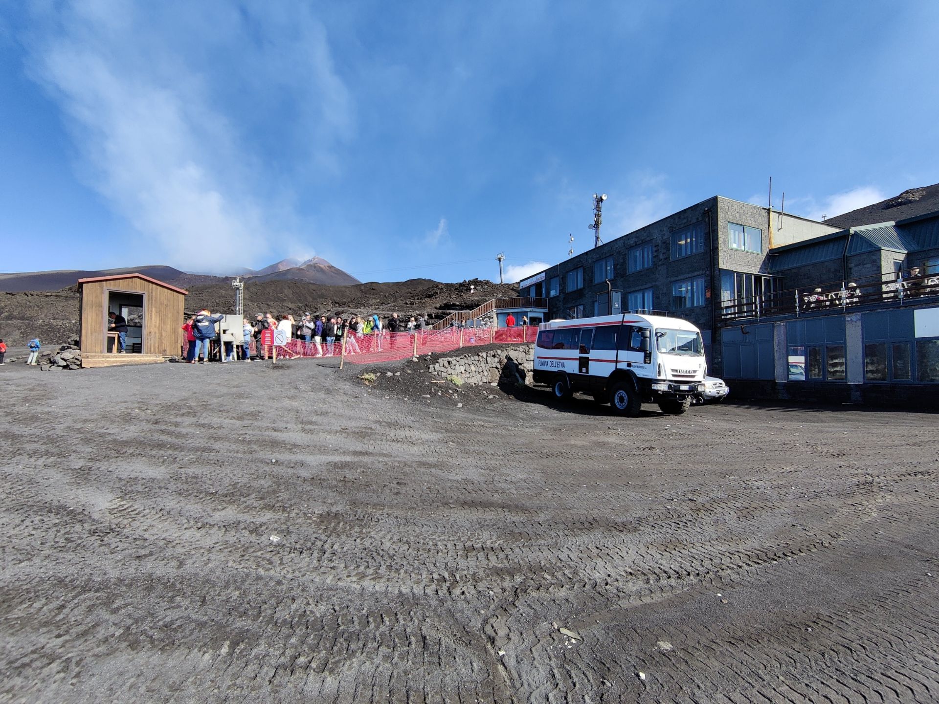
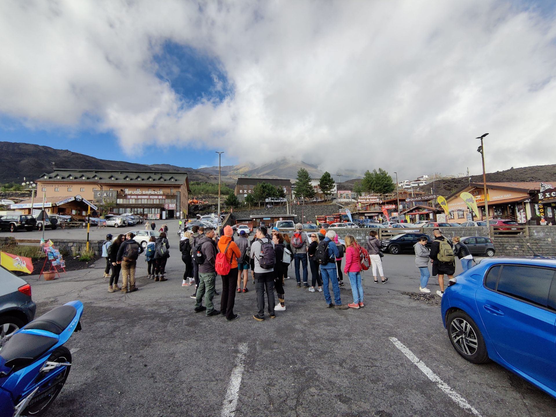
Before we left, a mountain guide from an agency came aboard to inform the passengers of the guided tours (65 euros per person!) he could offer in both English and Italian, and where to find the agency stall at the Rifugio Sapienza. After about half an hour of driving, we came to the Rifugio Sapienza, where the driver made a dedicated stop at the agency stall, and most of our fellow passengers got out here to join the guided tour. The bus then drove a few hundred meters more, and stopped just below the cable car station. It should be mentioned that Rifugio Sapienza is not some secluded mountain hut surrounded by nature, but rather a buzzing mountain village (albeit without staying residents) full of restaurants, gift shops, mountain guide agencies and gear shops, where you can buy or rent gear if you have come unprepared.
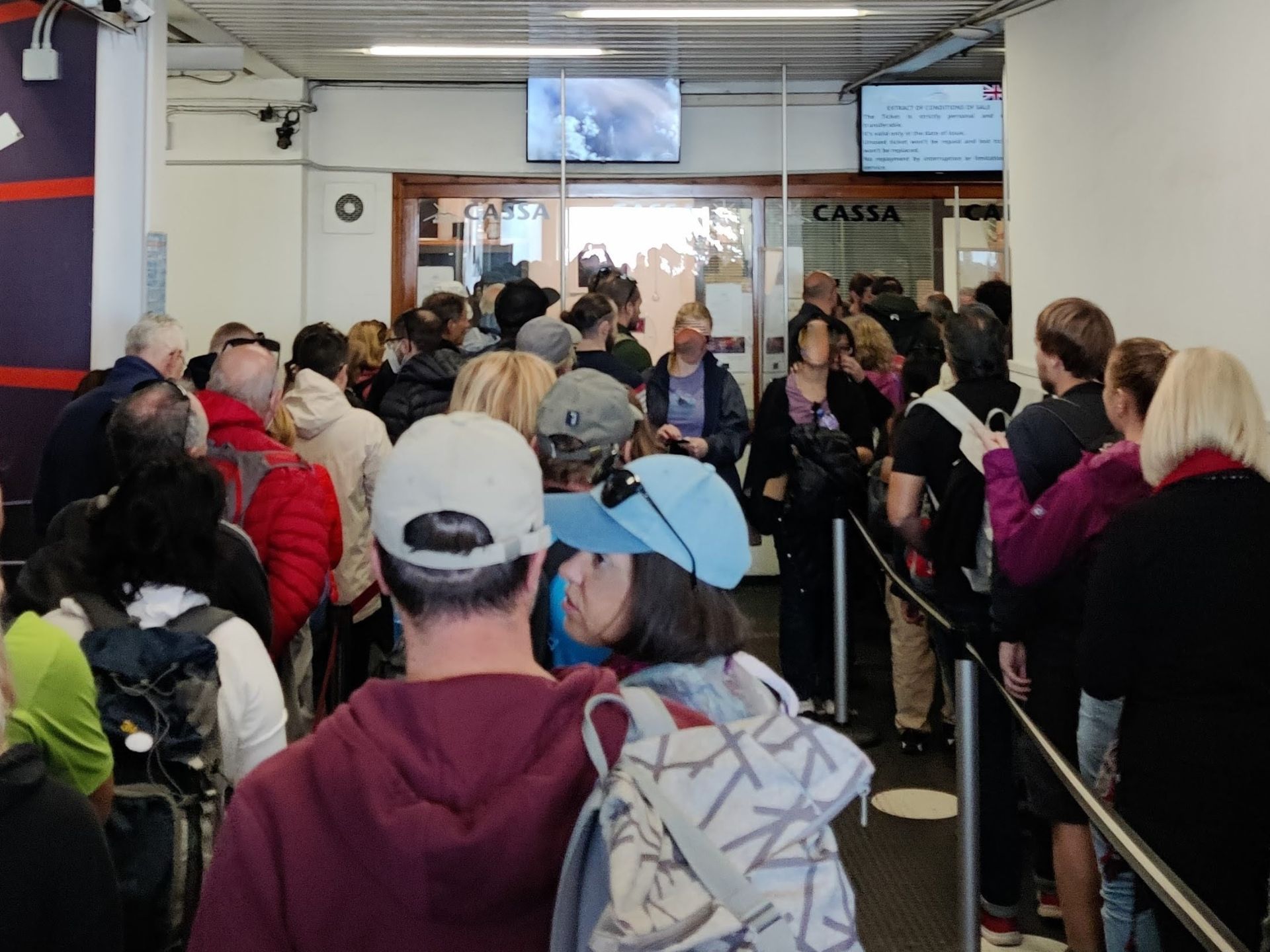
There are also a few different accommodation options. We made a quick stop at the mountain hut café for a coffee and rearranging our gear. Then we walked up to the cable car station and got in line outside. Had we skipped the coffee, we might have avoided the crowds lining up to go with the cable car entirely, but it got even worse behind us as incoming tourist busses spat out more and more people. There were two lines – one for guided groups, and one for individual visitors like us. Once inside the building we were met with screens advising us in various European languages that without a guide one was not allowed to go beyond 2500 meters (the altitude of the cable car terminal) and even with a guide one could only go to 2700 meters above sea level due to the activity of the volcano at the time.
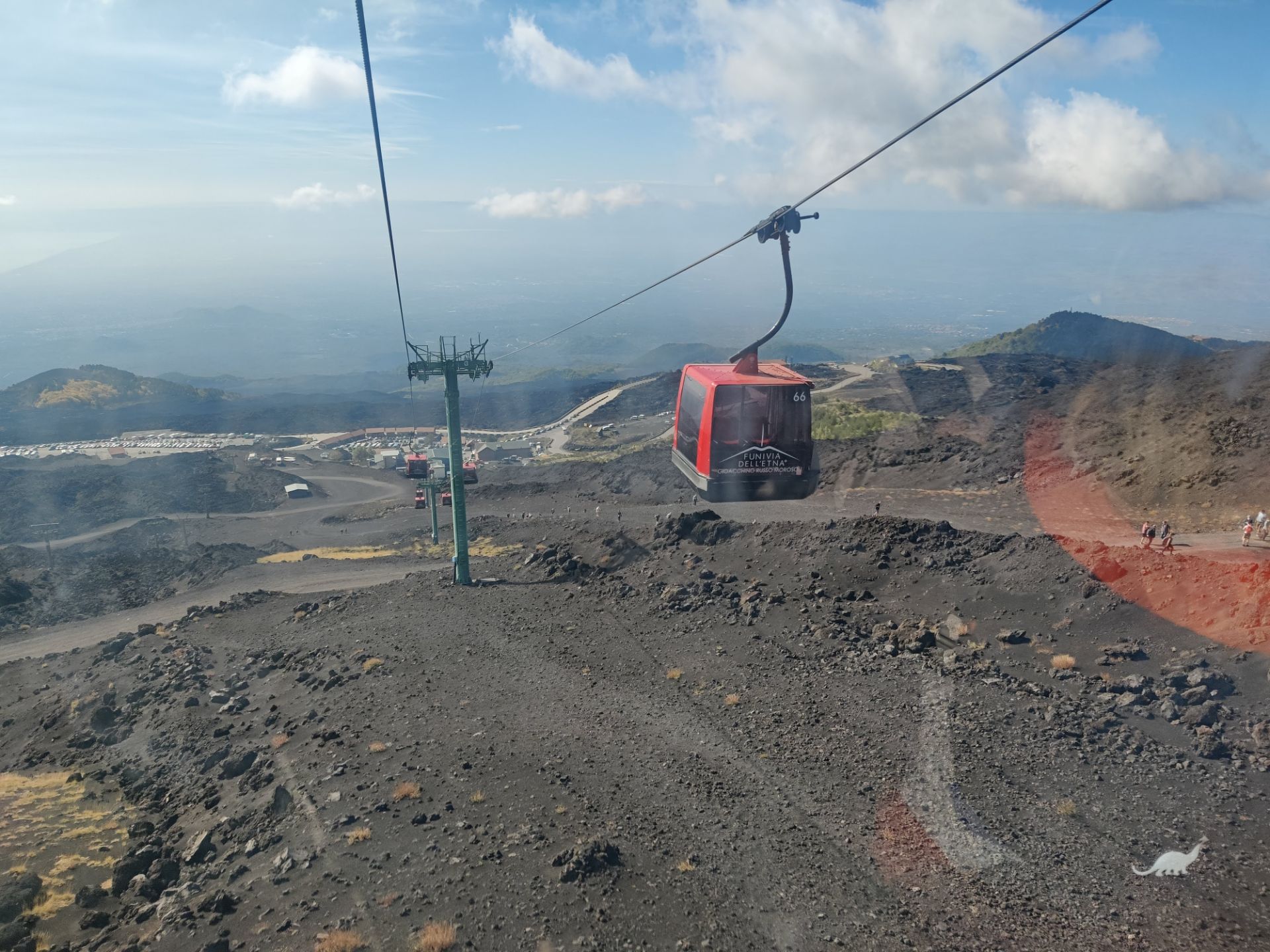
At the ticket office for the cable car, we could choose between return tickets for the cable car (one-way not an option!) at the price of 30 euros for adults (children aged 5-11 years 23 euros; younger for free), or 68 euros for the cable car ride as well as a trip with 4×4 bus up to 2700 meters with a mountain guide. We stuck to the cable car ride only, and were very happy that we did as will be explained in the conclusion. The cable car ride up was breathtaking, and we felt a bit sorry for those who had chosen to walk up to the cable car terminal from Rifugio Sapienza. Not least because many were in sneakers and jeans or even shorts.
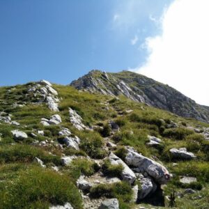
Trail
The hiking trail starts just outside the upper cable car station Terminal Funivia dell’Etna. Here we saw people who purchased the extended ticket stand outside in line in the cold and wait for the 4×4 busses to pick them up. As mentioned above, the screens at the cable car station had stated that nobody should go higher than 2500 meters, i.e. the altitude of the cable car terminal without a certified guide. Nevertheless, we saw many people who were clearly not part of any guided group venture higher, including people on mountain bikes. Now, we don’t want to encourage to civil disobedience, or more importantly, to put anybody in danger because Mount Etna is one of the most ACTIVE volcanos in the world and it could be fatal to stray from the beaten path without a certified mountain guide who are well aware of the known dangerous areas and can spot new ones as well.
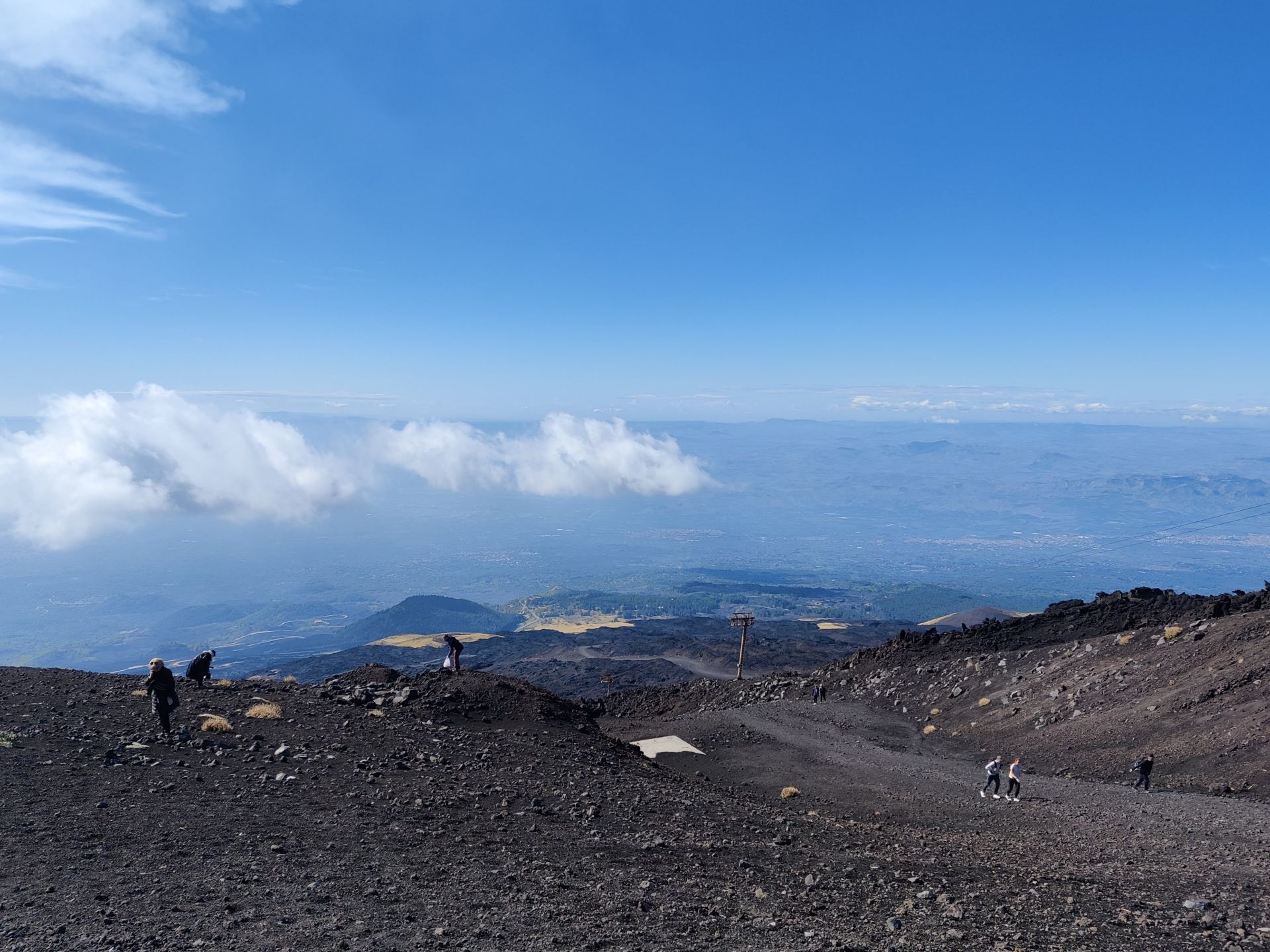
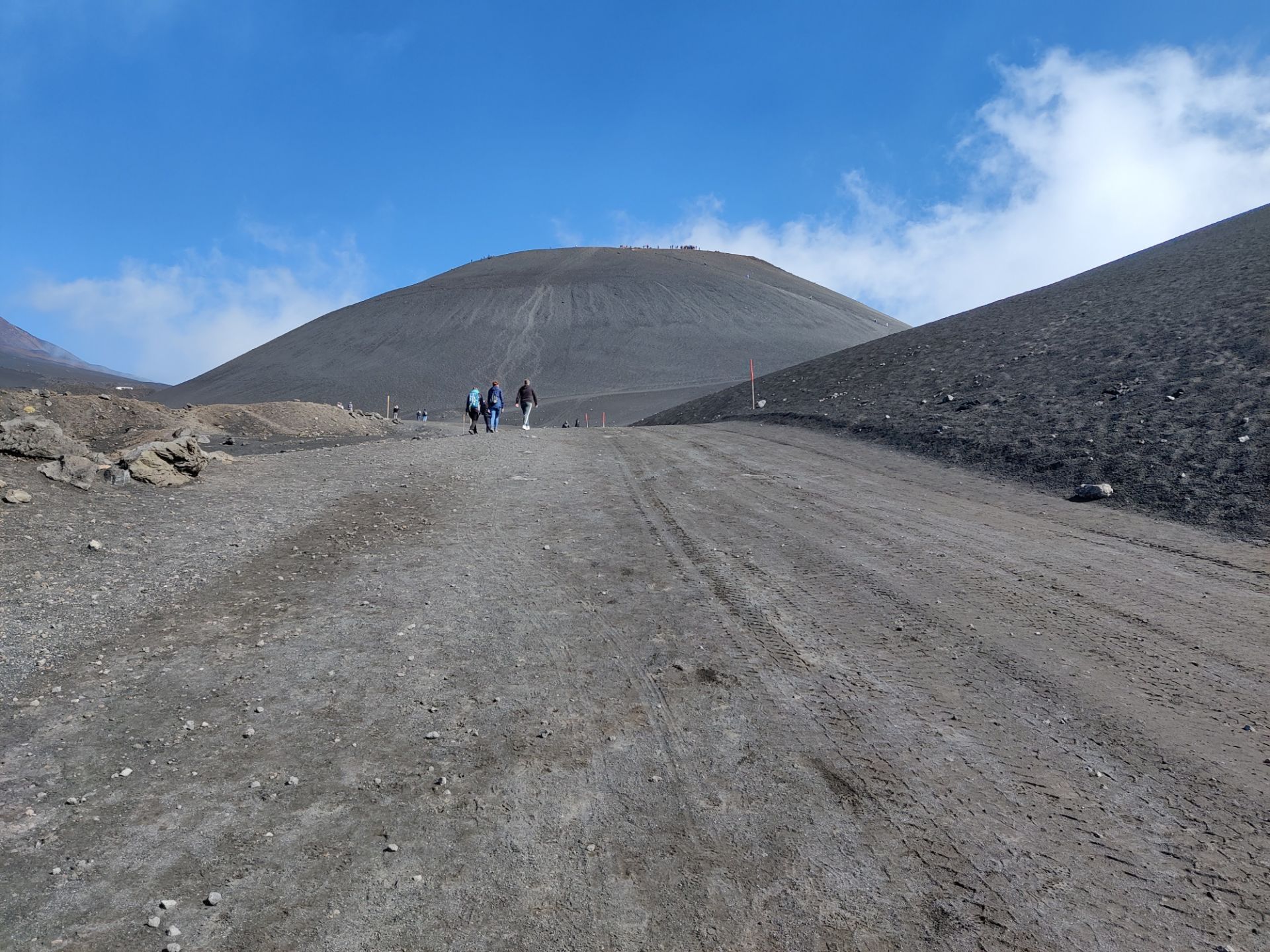
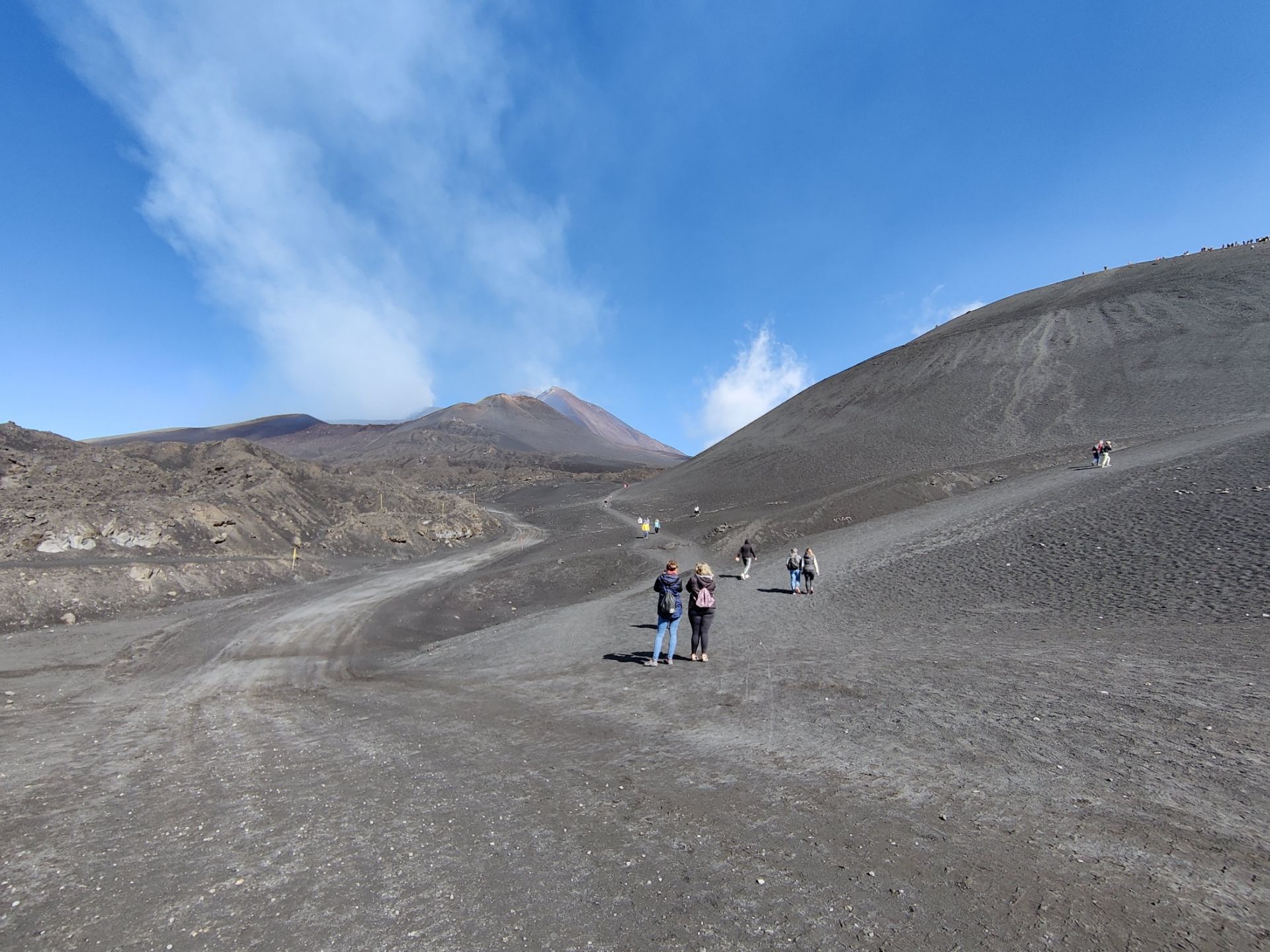
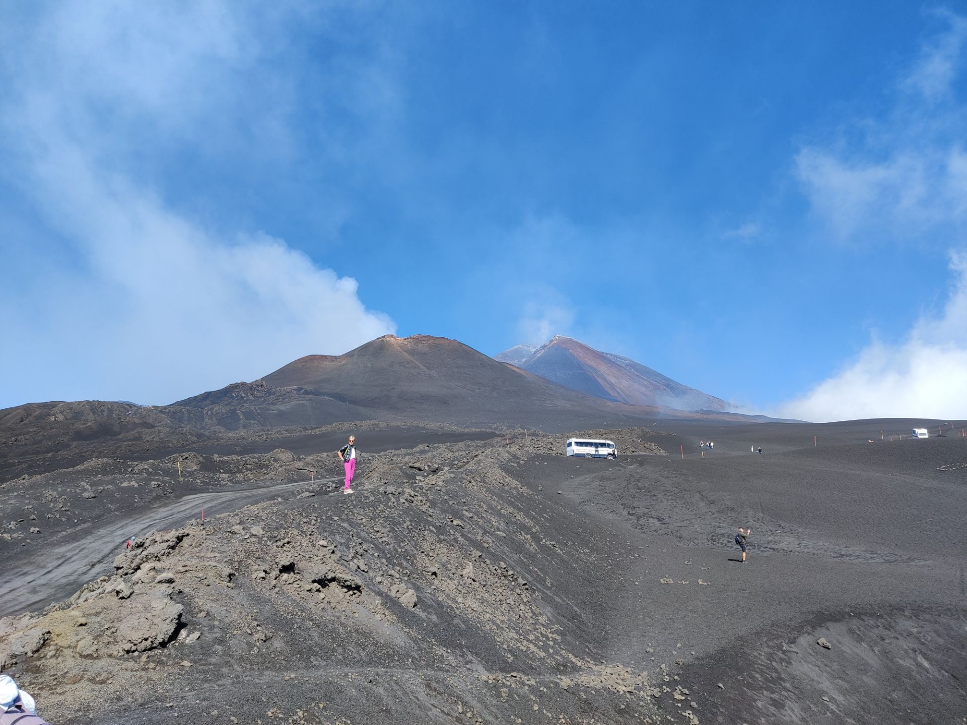
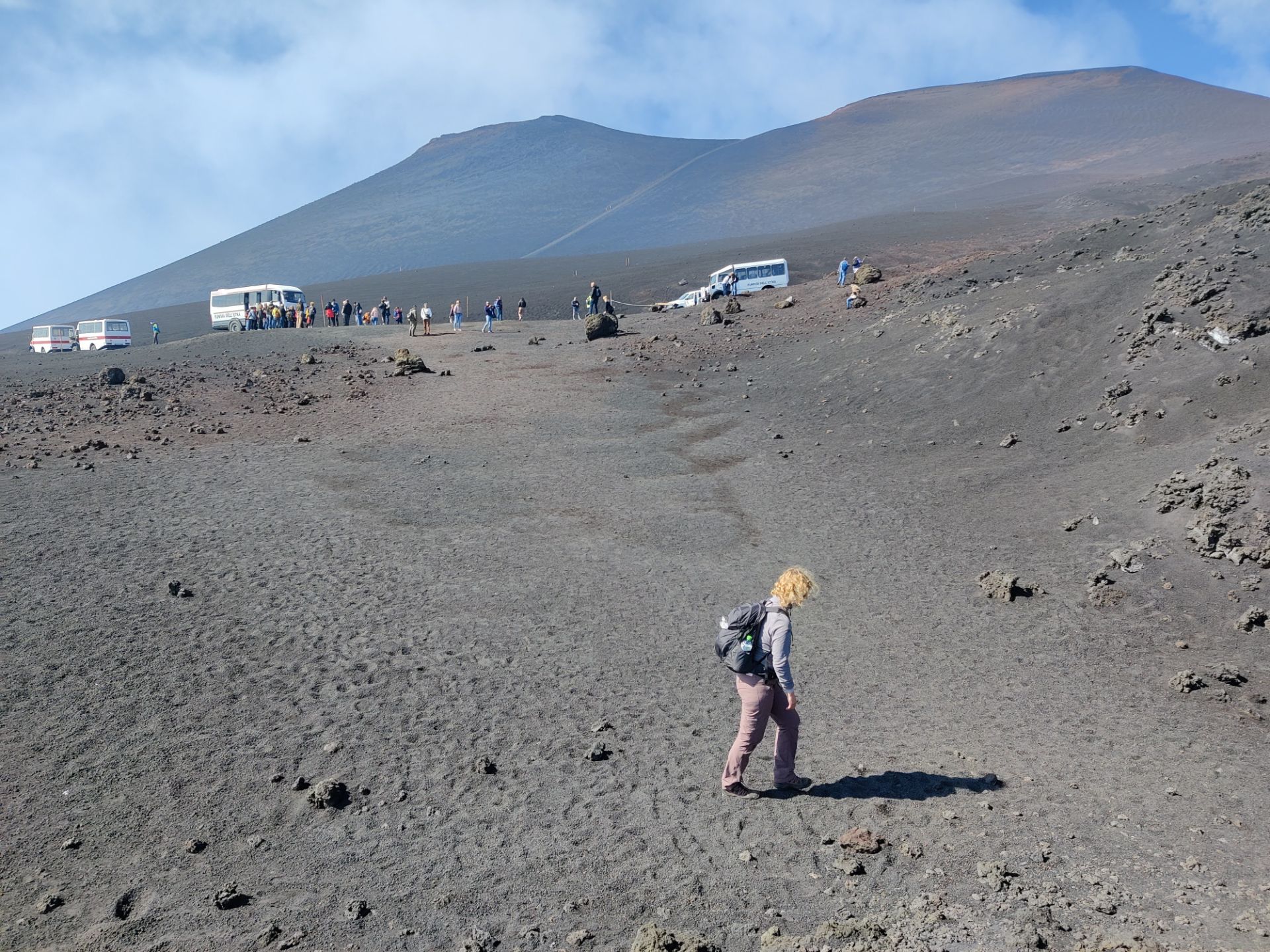
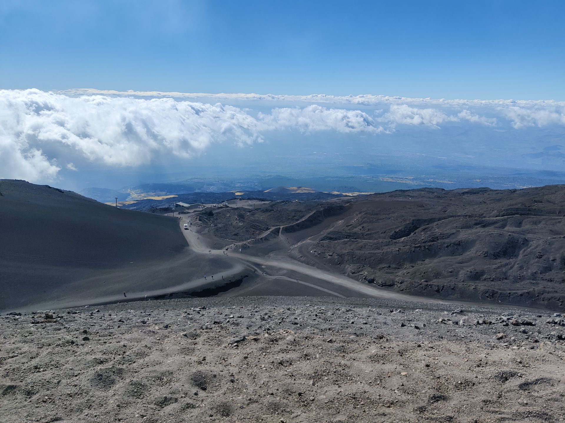
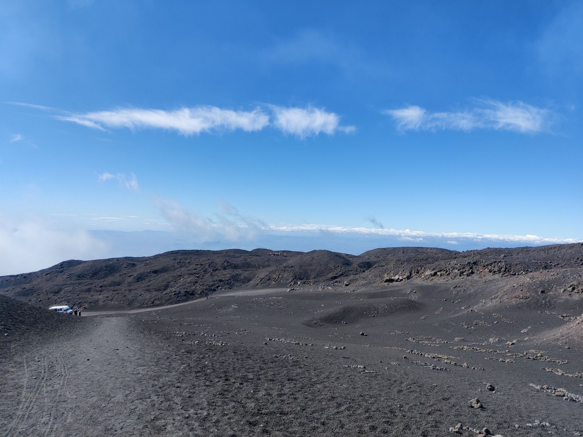
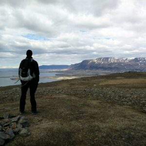
Therefore, our logic was to more or less follow the dirt road for the 4×4 busses and mountain bikes, assuming it would be safe there for us too. After having admired the view of the sea and valleys below, we started following the dirt road up towards northeast through the gentle sloping volcanic landscape which reminded us of our hikes in Iceland. After 500 meters of walking, we saw a footpath to the east leading up to the crater called Cratere Laghetto, but we decided to leave it for later. We did, however, take another footpath which went more or less parallel to the dirt road to avoid the noise and dust from the 4×4 busses. This footpath intersected with the dirt road after about 400 meters of walking.
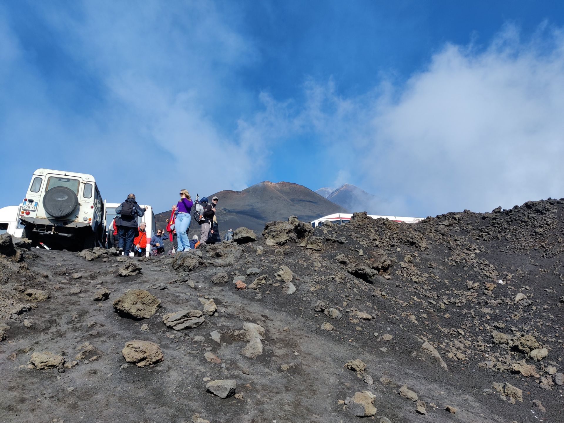
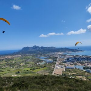
Here, several busses stopped to let guided groups go climb the steep crater (at 2672 meters of altitude), and then drove further up the road to park near the viewpoint called Belvedere at 2700 meters. We followed suit, although we mostly kept a distance of 10 meters to the road. Other than the occasional bus, we only met few other individual hikers on our way. That changed when we came close to the Belvedere viewpoint after about 2.5 kilometers of walking altogether. Here, the tourists flocked after having walked 200 meters from the parked busses but honestly there wasn’t much of a view because a cloud was coming in and blocking the view of the sea and the steep mountain slopes beneath towards east.
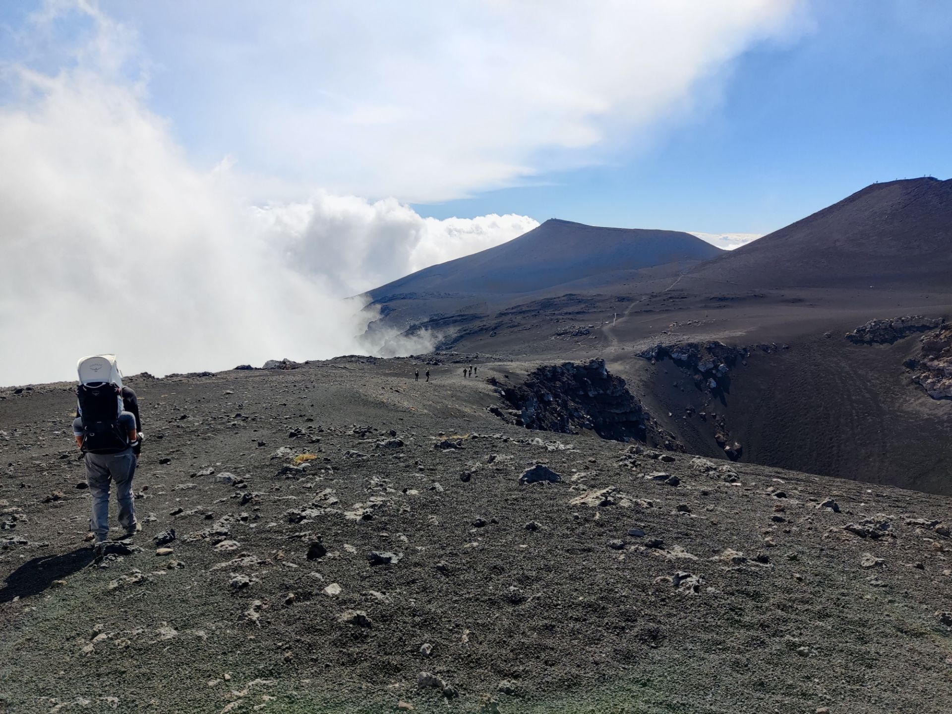
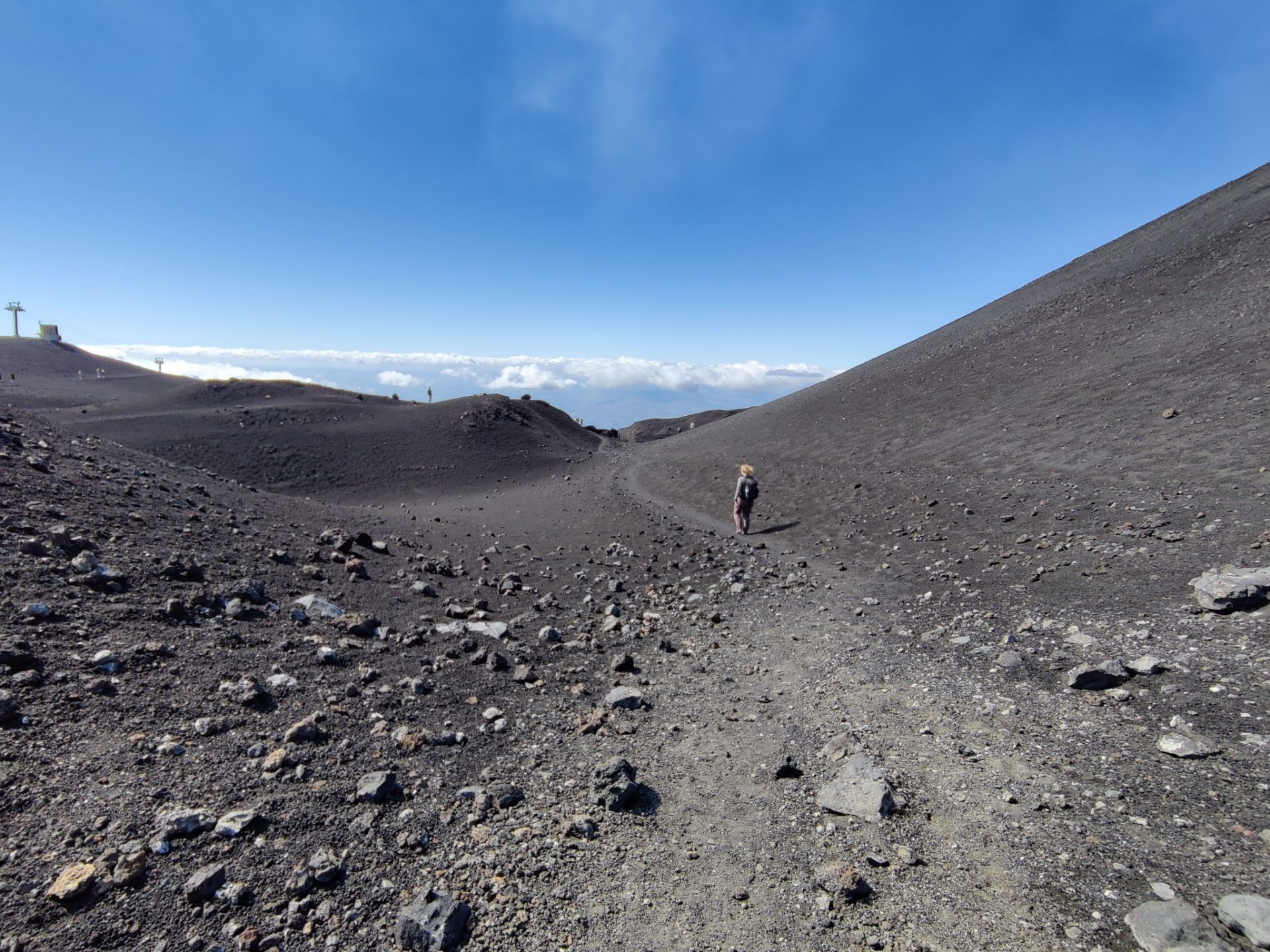
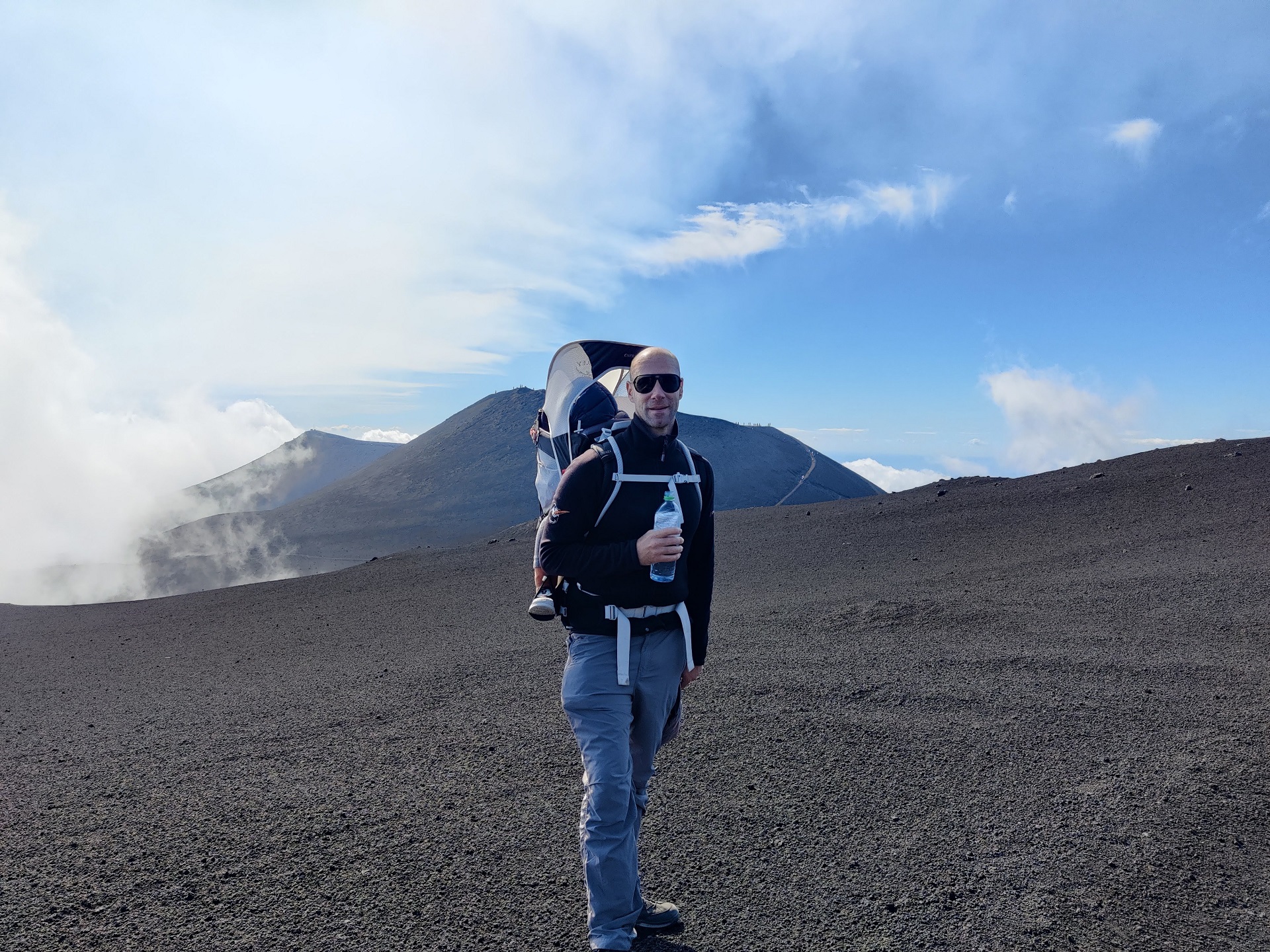
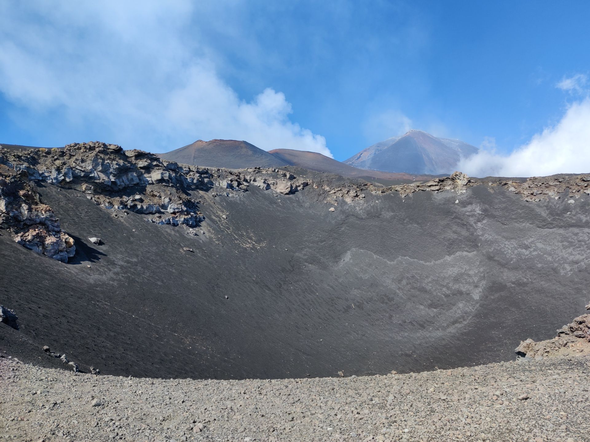
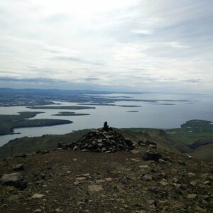
Nevertheless, it was close to Belvedere that we were at the highest altitude of the day – 2728 meters above sea level. We stuck to the same road down for the first kilometer, but then felt confident enough to go towards the footpath called Sentiero Cisternazza, which starts a bit below from Belvedere (at about 2700 meters) and follow the eastern mountain ridge quite closely towards south, past the Cisternazza depression. After the Cisternazza hollow, the path forks into two, and we took the right going towards the Laghetto crater, rather than following the Sentiero Cisternazza path down to the Montagnola crater. We then ascended up to the Laghetto crater from the southern slope, which meant that we mostly avoided the tourists walking up from the northern side (where the dirt road for the busses runs) until the very top.
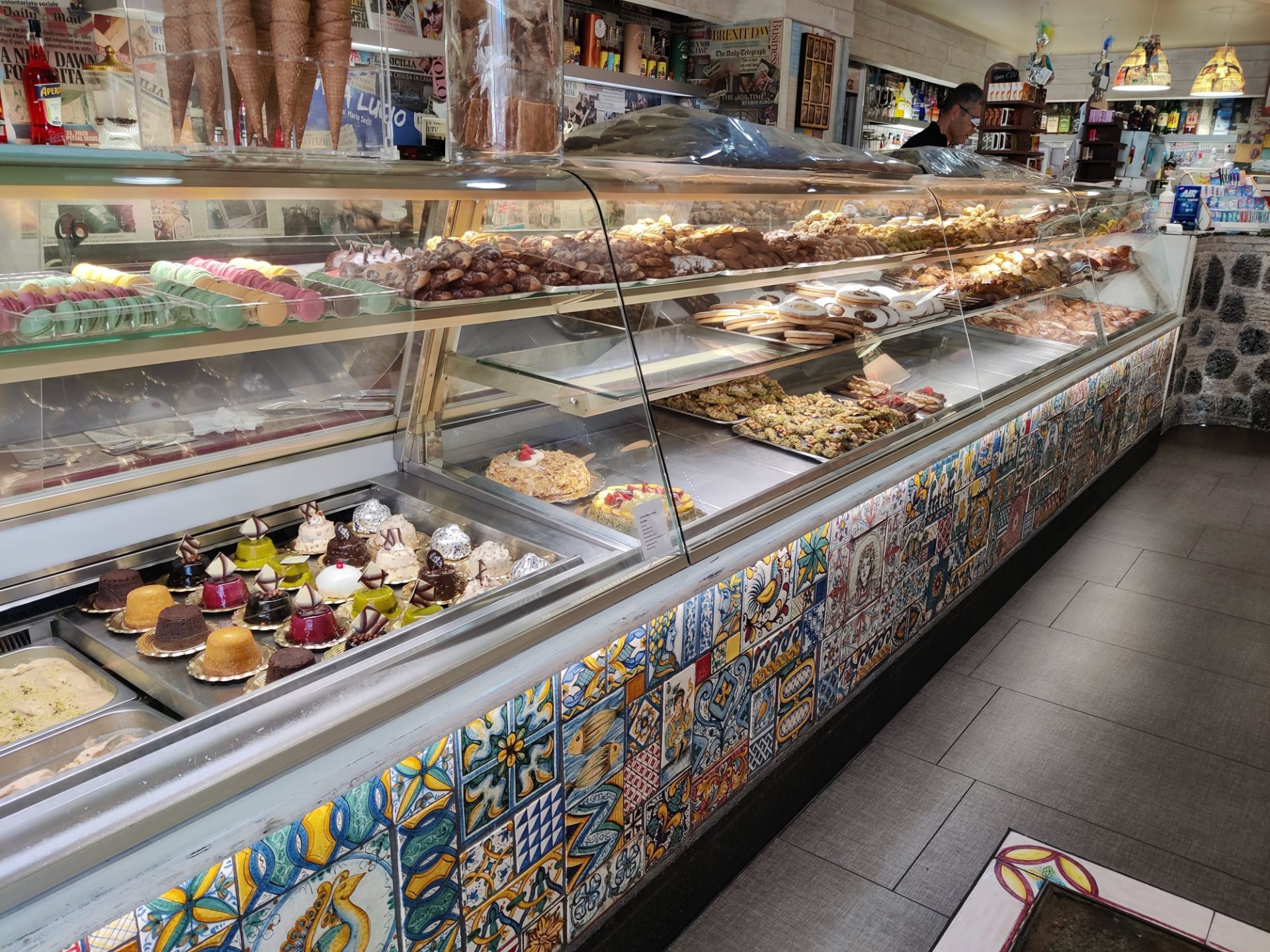
Coming down from the crater the same way, we took a short break in a hollow at the foot of the crater which gave us some shelter from the ever stronger wind gusts. Here we also encountered the only up-close sign of volcanic activity; a fuming fissure in the ground. Then we followed the foot path back to the dirt road and made our way down to the cable car terminal. Here we enjoyed some hot coffee, cocoa and cake, and then bought a few souvenirs in the gift shop. People were now standing in a long queue to take the cable car down, so we waited till there was a bit more air to breathe. Still, we took the cable car down about an hour before the planned departure of the AST bus back to Catania at 4.30 p.m. We had a snack of arancini (fried rice balls) at the Rifugio Sapienza café, and then began to scout for the bus, which was parked on a higher plateau.
When it finally made its way down to the main parking lot, it did not stop where it left us below the cable car station, but 50 meters away at the parking lot just above the restaurant called Terrazza dell’ Etna.We only spotted one bus, and a whole lot of people were waiting for it, so we made sure to squeeze onboard as quickly as possible. Some people tried to buy a ticket, but the driver refused, and they were left behind. Still, the bus was so full that 4-5 people had to stand up on the meandering road back to Catania. Again, the bus left 10-15 minutes before the scheduled departure, so we advise you to be there half an hour early. This time, the bus did not make a stop in Nicolosi but it still took more than an hour to return to the bus station in Catania due to heavy traffic. According to the schedule, the ride should take two hours in each direction.
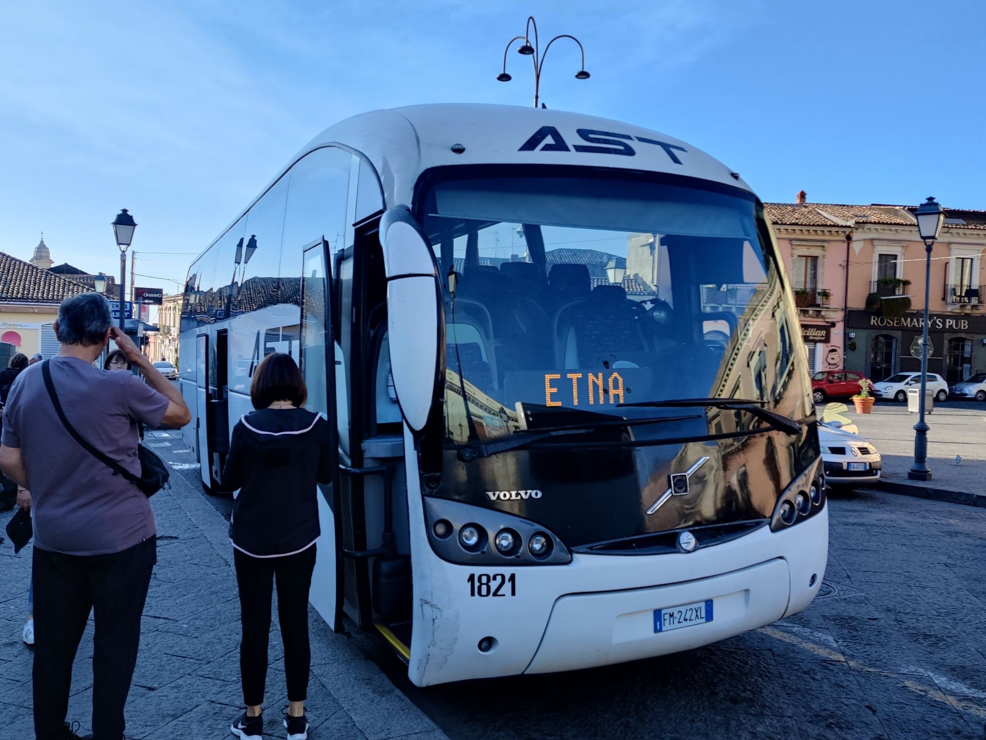
Mount Etna Hiking Trail – the AST bus making a stop in Nicolosi
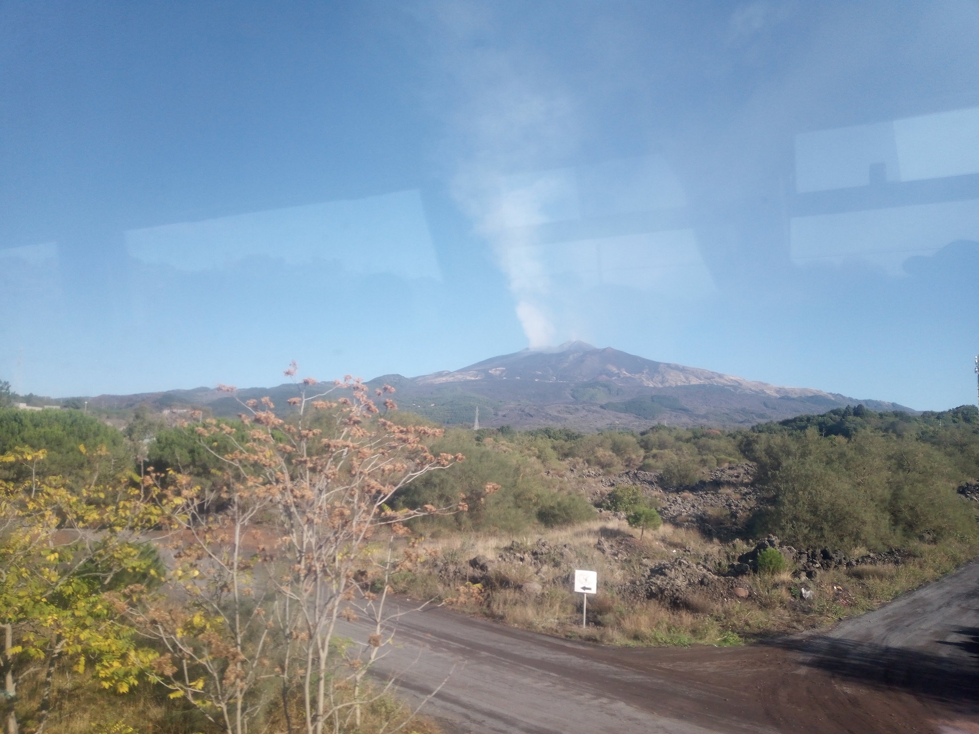
Mount Etna Hiking Trail – the volcano is visible from far away as you are approaching by bus
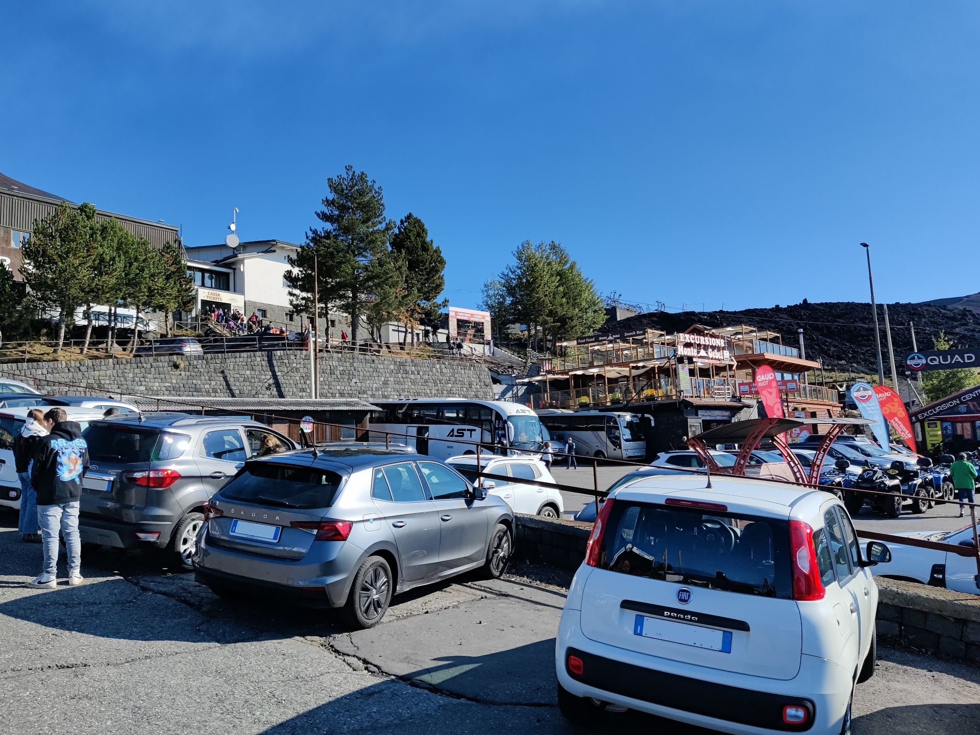
Mount Etna Hiking Trail – the AST bus parked below the cable car station at the buzzing Rifugio Sapienza.
Mount Etna Hiking Trail – queue outside for the cable car. Individuals to the left; guided groups on the right.
Mount Etna Hiking Trail – queueing inside for the cable car. Notice screen with warning to ascent higher than 2500 m. without a guide.
Mount Etna Hiking Trail – view from cable car on the way up.
Mount Etna Hiking Trail – you can also skip the cable car and make the ascent to the terminal by foot.
Mount Etna Hiking Trail – people queueing outside the terminal building to board a 4×4 bus
Mount Etna Hiking Trail – walking up the dirt road from the cable car terminal
Mount Etna Hiking Trail – foot paths to the right running up to and below Cratere Laghetto
Mount Etna Hiking Trail – foot path intersecting with dirt road again
Mount Etna Hiking Trail – walking more or less along the dirt road up towards Belvedere
Mount Etna Hiking Trail – 4×4 busses stop about 200 meters from Belvedere viewpoint
Mount Etna Hiking Trail – heading south along ridge past Cisternazza
Mount Etna Hiking Trail – footpath at the southern slope of Cratere Laghetto
Mount Etna Hiking Trail – view towards south from Cratere Laghetto. Footpath on the left leads to dirt road going down to cable car terminal.
Equipment
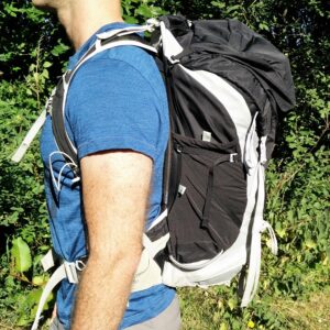
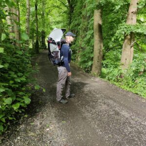
For this hike I dressed in layers, anticipating the drop in temperature the higher we ascended on the windy mountain. Therefore, I wore my Montane Terra Pack pants and Ibex Merino Boxers, and on top a long-sleeved Merino base layer and a Polartec fleece jacket. I also had my insulated CimAlp jacket with me. On my head I wore a base ball cap, but honestly I could have used a warmer beanie at times. I carried our daughter MK in the Osprey Poco child carrier, while Laura carried water (tap water in Sicily is usually drinkable, but foul-tasting in general), snacks and supplies in the CamelBak Rim Runner.
Equipment under scrutiny
Ibex Natural Boxers
The Natural boxers from Ibex Merino kept me warm and comfortable throughout the Etna hike
The Ibex Natural Boxers are made of Merino wool and Nylon. Because of their breathability and moisture-wicking performance they’re perfect for hiking and other aerobic sports. The boxers are also quick drying and antimicrobial. The fabric is very smooth and soft and thus the boxers are very comfortable. You can read the full review of the Ibex boxers here.

Conclusion and photo gallery
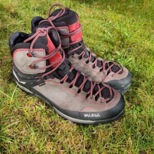
Mount Etna is an amazing destination to visit, regardless of the distance you choose to hike. You can walk all the way up from Rifugio Sapienza; you can take the cable car and then hike like we did, or you can opt for the 4×4 bus tour and only walk from the bus to the top of Cratere Laghetto and/or the Belvedere viewpoint. We felt like we got the best of the best by using the cable car and then continuing by foot as we avoided more queuing, the crowds, and just being able to enjoy the volcanic landscape in our own pace and company. If you choose to hike all the way, you will need proper hiking boots and pants for the steep ascent; otherwise, trekking shoes will be fine as it’s not a technically difficult terrain or trail. Be sure to dress appropriately in layers as the weather at high altitudes can change dramatically with little warning, and remember that the temperature on top of Mount Etna will be at least 10- 15 C lower than in the lowlands depending on the season and weather.
Avoid going if the weather forecast is bad; both for safety, and because you might not be able to see much of the fantastic landscape in very cloudy/foggy weather. You can buy refreshments both at Rifugio Sapienza and the café at the cable car terminal, but as a minimum you should bring enough water for your immediate needs. At the time of our visit it was prohibited to go higher than 2700 meters (even with a guide), which was generally respected although we saw a few guided groups ascend Crateri Barbagallo (2900 meters) with helmets and full gear. This may change according to the current activity level of the volcano. If you choose to go without a guide, like we did, have your wits with you and do not venture far beyond the beaten path or much out of sight from other groups. Obey immediately if a park official tells you to return to safer grounds – you don’t want to be the cause of an expensive helicopter rescue!
Mount Etna Hiking Trail - make a delicious purchase at the Dolce Vita Cafe in Nicolosi to use the restroom
Mount Etna Hiking Trail - volcano field filled with names written with stones
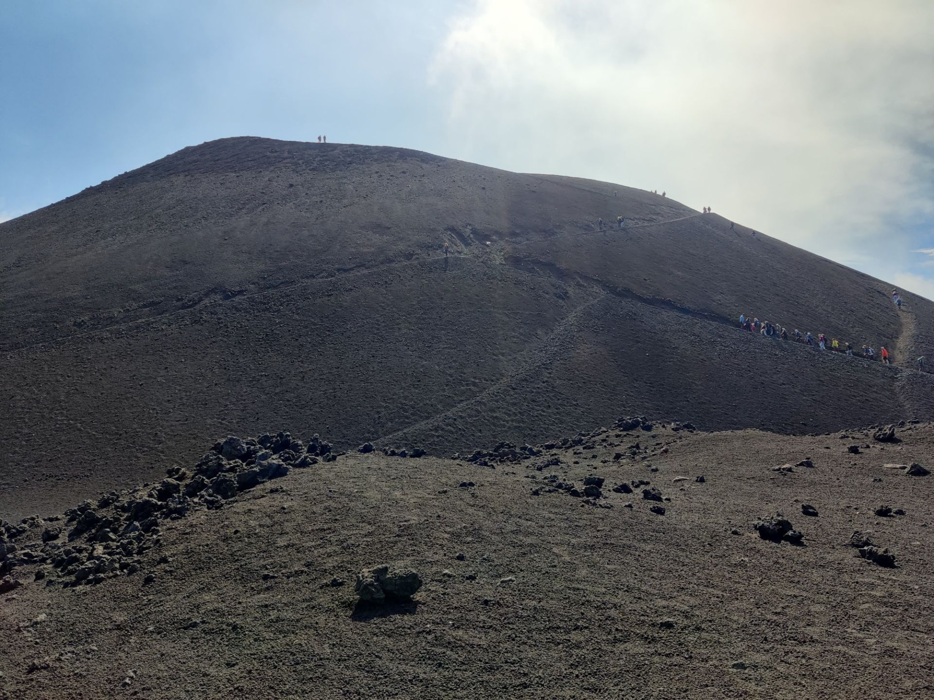
Mount Etna Hiking Trail - people ascending Crateri Laghetto
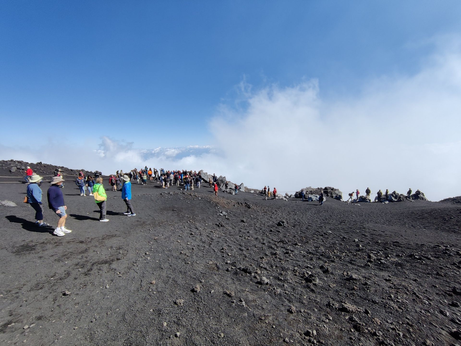
Mount Etna Hiking Trail - not much of a view at the Belvedere viewpoint
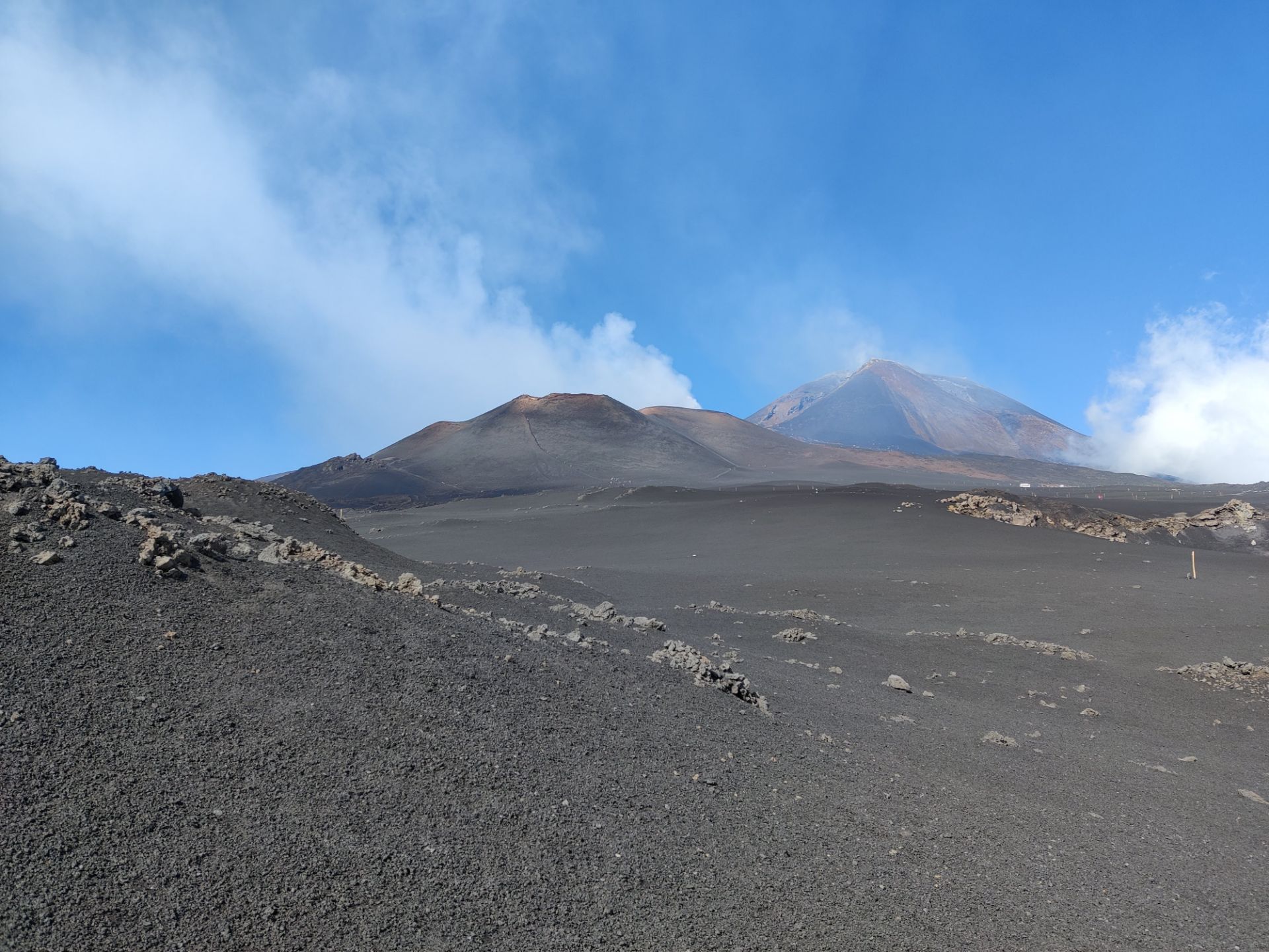
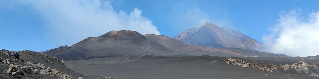
Mount Etna Hiking Trail - view on Crateri Barbagallo and Etna fuming
Mount Etna Hiking Trail - the Cisternazza hollow
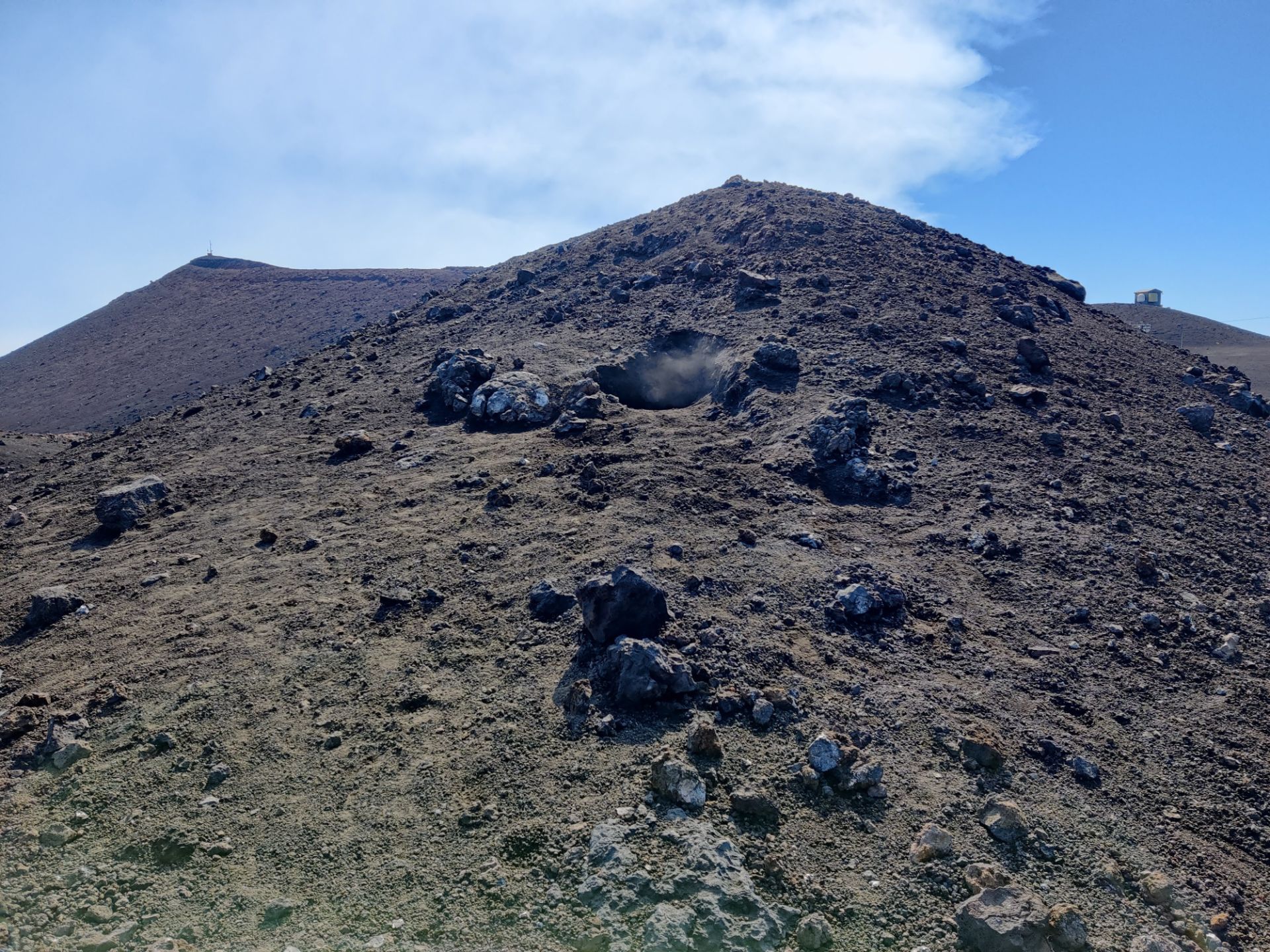
Mount Etna Hiking Trail - a fuming hole in a hilltop below Crateri Laghetto
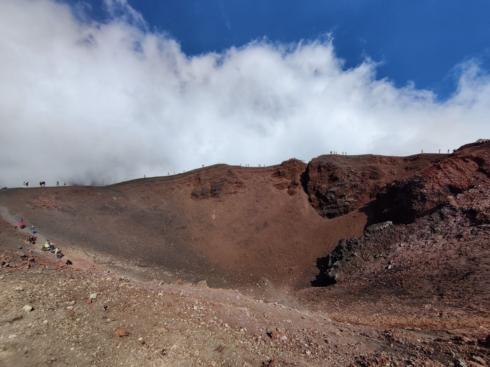
Mount Etna Hiking Trail - people circling around the top of Crateri Laghetto
Mount Etna Hiking Trail - people crowding to return with AST bus from parking lot
If you have any questions about this hike, please drop us a line in the comments below.


we are going to mount etna in a couple of weeks – we will have a car – should we drive to the cable car and then walk? Do we need / can we get a guide from there?
Hi Lucinda,
If you have a car, you should drive to the cable car station and then either walk or take the cable car. If you want a guided tour, you can find the agency stall at Rifugio Sapienza (next to the cable car station). We didn’t go on a guided tour and we were quite happy with what we saw. Nevertheless, with a guide you’re allowed to go a bit higher up the mountain.
I wish you a nice trip to Sicily.
Best regards,
Blaz
Hey Blaz,
What footwear would you recommend? For mid-April? Is it snow?
Best,
Jess
Hi Jess,
I was wearing my Lowa Renegade hiking shoes but that was in October. Now, it seems there is snow. You can check the live cam here to see the conditions. So, it might be a good idea to bring more robust hiking shoes and maybe even crampons, depending on how much you want to hike around the mountain.
I wish you a nice trip!
Blaz